
KANHARGAOV RESERVOIR
A view on the lake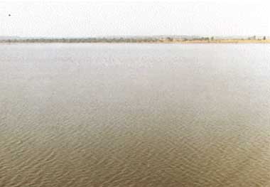
Photo: K.S.Unni
A. LOCATION
- Madhya Pradesh, India.
- 22:05N, 78:45E; 717 m above sea level.
B. DESCRIPTION
-
Kanhargaov Reservoir is located in Chhindwara district near the southern boundary of the province of Madhya Pradesh, Central India. The district is well known for its coal mines which have been producing coal during the past half century. This area is hilly with undulating topography, belonging to Mahadeo Range of Saptura Mountains and reaching a height range of 1,000 1,500 m above sea level both to the north and in the southern part of the district.
The reservoir, the largest one in the district, was constructed in 1986 at a cost of 14 million rupees by impounding the River Kulbehra which is a tributary of the Pench River (in the Godavari River system) originating from the central plateau of the district. The dam site is at a distance of 25 km from Chhindwara town, and the reservoir serves as the main source of drinking water for the town.
C. PHYSICAL DIMENSIONS
| Surface area [km2] | 6.1 |
| Volume [km3] | 0.0281 |
| Maximum depth [m] | 20.9 |
| Water level | Regulated |
| Normal range of annual water level fluctuation [m] | 2 4 |
| Length of shoreline [km] | 18.6 |
| Catchment area [km2] | 108 |
D. PHYSIOGRAPHIC FEATURES
D1 GEOGRAPHICAL- Number of main islands: None.
- Number of outflowing rivers and channels (name)
2 (R. Kulbehra, a canal for drinking water supply).
- Climatic data at Chhindwara, 1991
| Jan | Feb | Mar | Apr | May | Jun | Jul | Aug | Sep | Oct | Nov | Dec | Ann. | |
|---|---|---|---|---|---|---|---|---|---|---|---|---|---|
| Mean temp. [deg C] | 15 | 18 | 20.5 | 29.5 | 35 | 28.5 | 25 | 26 | 28 | 25.5 | 18.5 | 15.5 | 23.8 |
| Precipitation [mm] | - | 6 | 28 | - | - | 63 | 269 | 282 | - | - | 23 | - | 671+ |
- Water temperature [deg C]
| Deepest point, 1990 1992 | ||||||||||||
| Depth [m] | Jan | Feb | Mar | Apr | May | Jun | Jul | Aug | Sep | Oct | Nov | Dec |
|---|---|---|---|---|---|---|---|---|---|---|---|---|
| 0 | 22.5 | 23.2 | 24.5 | 29.7 | 28.0 | 29.0 | 28.0 | 28.2 | 30.0 | 29.5 | 24.0 | 22.6 |
| 0.5 | 22.0 | 22.5 | 24.2 | 29.0 | 27.7 | 28.2 | 27.0 | 27.8 | 29.0 | 28.2 | 26.4 | 21.5 |
| 1 | 21.5 | 21.7 | 23.5 | 28.5 | 27.2 | 27.7 | 27.0 | 27.2 | 28.7 | 27.7 | 23.0 | 21.2 |
| 3 | 21.0 | 21.0 | 22.0 | 28.0 | 27.0 | 27.2 | 26.7 | 26.8 | 28.2 | 26.5 | 22.8 | 21.1 |
| 6 | 20.5 | 20.2 | 21.7 | 27.5 | 26.7 | 27.0 | 26.5 | 25.8 | 26.2 | 26.0 | 22.0 | 20.0 |
| 9 | 20.0 | 20.0 | 21.0 | 26.5 | 26.2 | 26.7 | 25.5 | 25.2 | 25.7 | 25.5 | 21.3 | 20.0 |
| 12 | 19.0 | 19.2 | 20.2 | 25.5 | - | - | - | 24.7 | 25.7 | 24.5 | 19.6 | 19.2 |
- Freezing period: None.
- Mixing type: Polymictic.
- Notes on water mixing and thermocline formation
The reservoir lacks a true thermocline. Thermal gradient is poorly developed and ill defined as in other tropical type reservoirs.
E. LAKE WATER QUALITY (Q)
E1 TRANSPARENCY [m] (1990) (1991)| Depth [m] | Jan | Feb | Mar | Apr | May | Jun | Jul | Aug | Sep | Oct | Nov | Dec |
|---|---|---|---|---|---|---|---|---|---|---|---|---|
| - | 0.65 | 0.55 | 0.60 | 0.80 | 0.80 | 0.30 | 0.35 | 0.55 | 0.80 | 0.85 | 0.80 | |
| Depth [m] | Jan | Feb | Mar | Apr | May | Jun | Jul | Aug | Sep | Oct | Nov | Dec |
| 0.85 | 0.95 | 1.00 | 1.00 | 1.10 | 1.05 | 0.80 | 0.40 | 0.65 | 0.80 | 1.05 | 1.00 |
| Deepest point, 1990 1992 | ||||||||||||
| Depth [m] | Jan | Feb | Mar | Apr | May | Jun | Jul | Aug | Sep | Oct | Nov | Dec |
|---|---|---|---|---|---|---|---|---|---|---|---|---|
| 0 | 8.30 | 8.00 | 8.15 | 8.40 | 8.25 | 8.25 | 7.75 | 8.20 | 8.30 | 8.25 | 8.30 | 8.30 |
| 0.5 | 8.30 | 8.07 | 7.98 | 8.25 | 8.22 | 8.20 | 7.80 | 8.25 | 8.30 | 8.30 | 8.35 | 8.30 |
| 1 | 8.20 | 7.95 | 7.82 | 8.22 | 8.16 | 8.15 | 7.50 | 8.21 | 8.30 | 8.25 | 8.00 | 8.19 |
| 3 | 8.20 | 7.97 | 7.82 | 8.18 | 8.13 | 8.09 | 7.45 | 8.19 | 8.25 | 8.21 | 7.94 | 8.15 |
| 6 | 8.15 | 7.96 | 7.71 | 8.12 | 8.12 | 8.05 | 7.35 | 8.15 | 8.22 | 8.15 | 7.82 | 8.10 |
| 9 | 8.12 | 7.89 | 7.66 | 8.12 | 8.10 | 8.03 | 7.30 | 8.02 | 8.15 | 8.12 | 7.75 | 8.08 |
| 12 | 8.10 | 7.80 | 7.63 | 8.50 | 7.90 | 8.01 | 7.10 | 7.92 | 8.10 | 8.02 | 7.70 | 8.10 |
| Deepest point, 1990 1992 | ||||||||||||
| Depth [m] | Jan | Feb | Mar | Apr | May | Jun | Jul | Aug | Sep | Oct | Nov | Dec |
|---|---|---|---|---|---|---|---|---|---|---|---|---|
| 0 | 11.27 | 11.31 | 9.57 | 9.08 | 8.53 | 8.59 | 8.92 | 8.84 | 9.30 | 10.39 | 10.78 | 10.83 |
| 0.5 | 11.49 | 10.68 | 9.89 | 9.93 | 8.85 | 8.92 | 10.23 | 9.16 | 9.88 | 9.14 | 9.80 | 10.02 |
| 1 | 8.87 | 9.45 | 9.03 | 8.59 | 8.62 | 8.50 | 8.91 | 8.04 | 8.48 | 8.80 | 9.07 | 8.91 |
| 3 | 6.80 | 7.43 | 7.71 | 7.41 | 7.82 | 8.34 | 7.73 | 6.70 | 7.11 | 6.45 | 6.56 | 6.29 |
| 6 | 6.68 | 6.44 | 7.65 | 6.69 | 6.24 | 5.80 | 5.96 | 6.01 | 5.74 | 4.92 | 5.47 | 5.30 |
| 9 | 4.90 | 6.22 | 7.00 | 5.30 | 5.53 | 5.40 | 5.36 | 5.72 | 3.39 | 3.55 | 4.21 | 4.21 |
| 12 | 4.92 | 5.69 | 5.80 | 4.42 | 4.59 | 4.70 | 5.56 | 4.57 | 3.33 | 3.33 | 3.45 | 3.88 |
- NH4-N [micro l-1]
| Deepest point, 1990 1992 | ||||||||||||
| Depth [m] | Jan | Feb | Mar | Apr | May | Jun | Jul | Aug | Sep | Oct | Nov | Dec |
|---|---|---|---|---|---|---|---|---|---|---|---|---|
| 0 | 250 | 230 | 200 | 245 | 290 | 345 | 425 | 450 | 310 | 225 | 345 | 275 |
| 0.5 | 275 | 250 | 210 | 250 | 305 | 400 | 400 | 415 | 310 | 250 | 305 | 285 |
| 1 | 215 | 245 | 162 | 260 | 305 | 390 | 410 | 420 | 310 | 242 | 275 | 230 |
| 3 | 210 | 255 | 225 | 285 | 295 | 390 | 385 | 405 | 310 | 240 | 240 | 205 |
| 6 | 205 | 225 | 210 | 280 | 300 | 390 | 425 | 340 | 305 | 240 | 245 | 210 |
| 9 | 205 | 215 | 205 | 270 | 255 | 425 | 450 | 445 | 320 | 225 | 215 | 210 |
| 12 | 200 | 215 | 200 | 272 | 270 | 500 | 490 | 460 | 290 | 240 | 210 | 205 |
- NO3-N [micro l-1]
| Deepest point, 1990 1992 | ||||||||||||
| Depth [m] | Jan | Feb | Mar | Apr | May | Jun | Jul | Aug | Sep | Oct | Nov | Dec |
|---|---|---|---|---|---|---|---|---|---|---|---|---|
| 0 | 285 | 240 | 207 | 203 | 205 | 295 | 390 | 385 | 290 | 203 | 300 | 230 |
| 0.5 | 310 | 280 | 175 | 213 | 227 | 287 | 350 | 390 | 295 | 205 | 267 | 260 |
| 1 | 250 | 217 | 180 | 210 | 245 | 325 | 390 | 325 | 252 | 205 | 245 | 230 |
| 3 | 220 | 275 | 227 | 207 | 230 | 325 | 360 | 350 | 257 | 202 | 202 | 210 |
| 6 | 230 | 237 | 222 | 215 | 260 | 360 | 325 | 347 | 262 | 203 | 202 | 200 |
| 9 | 205 | 242 | 230 | 210 | 240 | 360 | 365 | 360 | 295 | 202 | 205 | 190 |
| 12 | 210 | 232 | 205 | 207 | 270 | 335 | 400 | 405 | 250 | 205 | 202 | 390 |
- PO4-P [micro l-1]
| Deepest point, 1990 1992 | ||||||||||||
| Depth [m] | Jan | Feb | Mar | Apr | May | Jun | Jul | Aug | Sep | Oct | Nov | Dec |
|---|---|---|---|---|---|---|---|---|---|---|---|---|
| 0 | 65 | 63 | 40 | 51 | 80 | 93 | 110 | 180 | 100 | 95 | 80 | 77 |
| 0.5 | 70 | 60 | 42 | 57 | 80 | 82 | 100 | 170 | 90 | 85 | 70 | 70 |
| 1 | 65 | 71 | 42 | 60 | 68 | 80 | 138 | 185 | 95 | 82 | 65 | 65 |
| 3 | 65 | 62 | 46 | 50 | 80 | 88 | 130 | 185 | 100 | 82 | 55 | 55 |
| 6 | 55 | 45 | 45 | 60 | 75 | 95 | 82 | 170 | 100 | 80 | 60 | 60 |
| 9 | 70 | 37 | 45 | 45 | 78 | 100 | 130 | 175 | 100 | 82 | 60 | 65 |
| 12 | 70 | 41 | 42 | 55 | 70 | 100 | 160 | 165 | 105 | 95 | 75 | 68 |
F. BIOLOGICAL FEATURES (Q)
F1 FLORA- Emerged macrophytes: None.
- Floating macrophytes: None.
- Submerged macrophytes
Hydrilla verticillata, Najas minor, Chara sp., Potamogeton crispus, Vallisneria spiralis. - Phytoplankton
Cyanophyceae (Raphidiopsis (dominant throughout the year), Microcystis, Anabaena, Anabaenopsis, Oscillatoria, Spirulina, Merismopedia), Chlorophyceae (Spirogyra, Pediastrum strumeri, P. ovatum, P. simplex, Cosmarium, Scenedesmus dimorphus, S. bijuga, Botryococcus, Staurastrum, Chlorella, Phytoconis, Selenastrum), Bacillariophyceae (Nitzschia palea, N. acicularis, Navicula, Cymbella affinis, C. ventricosa, Melosira, Cyclotella, Synedra, Amphora, Gomphonema).
- Zooplankton
Rotifera (Keratella vulga, K. longiseta, K. cochlearis, K. quadrata, K. serrulata, K. erilina, K. stipitata K. faculatus, Brachionus plicatalis, B. calyciflorus, B. angularis, B. quadridentatus, B. bidentata B. falcatus, Notholca acuminata, Monostyla spp., Trichocerca spp., Filinia spp.), Copepoda (Diaptomus, Cyclops), Cladocera (Daphnia dubia, D. pulex, D. ambigua, D. magna, Diaphanosoma, Sida crystallina, Moina branchiata, Bosmina longirostris, B. coregoni, Alona monocantha, A. intermedia, A. affinis, Alonella). - Fish
Labeo rohita, L. calbasu, Cirrhina mrigala, Puntius sophore, Wallogonia attu, Channa punctatus, Catla catla.
| Deepest point, 1990 1992 | ||||||||||||
| Jan | Feb | Mar | Apr | May | Jun | Jul | Aug | Sep | Oct | Nov | Dec | |
|---|---|---|---|---|---|---|---|---|---|---|---|---|
| Net production | 1.04 | 1.18 | 0.93 | 0.93 | 1.34 | 0.80 | 1.14 | 1.57 | 1.54 | 2.65 | 1.35 | 0.82 |
| Dark respiration | 1.09 | 1.15 | 0.95 | 0.92 | 0.83 | 0.64 | 0.73 | 1.11 | 0.82 | 1.09 | 1.55 | 0.92 |
| Gross production | 2.13 | 2.33 | 1.87 | 1.85 | 2.17 | 1.44 | 1.87 | 2.68 | 2.37 | 3.74 | 2.89 | 1.73 |
- Biomass of phytoplankton [103 cells l-1]
| Deepest point, 1990 1991 | ||||||||||||
| D* | Jan | Feb | Mar | Apr | May | Jun | Jul | Aug | Sep | Oct | Nov | Dec |
|---|---|---|---|---|---|---|---|---|---|---|---|---|
| 0 | 26.72 | 28.64 | 30.20 | 21.08 | 21.11 | 35.06 | 20.36 | 43.64 | 61.70 | 88.68 | 55.82 | 25.10 |
| 0.5 | 16.42 | 20.11 | 48.93 | 28.92 | 33.04 | 67.20 | 47.32 | 44.68 | 22.38 | 29.74 | 55.86 | 14.40 |
| 1 | 4.13 | 33.35 | 49.54 | 37.18 | 32.78 | 46.96 | 37.02 | 87.18 | 56.27 | 69.94 | 62.76 | 2.10 |
| 3 | 1.60 | 7.41 | 7.23 | 2.09 | 3.49 | 40.72 | 9.84 | 45.37 | 32.53 | 47.59 | 9.90 | 1.06 |
| 6 | 1.06 | 7.03 | 9.08 | 1.58 | 3.49 | 63.02 | 34.35 | - | - | 63.57 | 8.90 | 0.83 |
| 9 | 0.31 | 1.53 | 8.54 | - | - | - | - | - | - | 37.88 | 1.05 | 1.9 |
| 12 | - | 0.84 | - | - | - | - | - | - | - | - | - | - |
- Biomass of zooplankton [ind. l-1]
| Deepest point, 1990 1992 | ||||||||||||
| Depth [m] | Jan | Feb | Mar | Apr | May | Jun | Jul | Aug | Sep | Oct | Nov | Dec |
|---|---|---|---|---|---|---|---|---|---|---|---|---|
| 0 | 882 | 1,410 | 1,936 | 1,622 | 228 | 193 | 110 | 275 | 514 | 453 | 436 | 367 |
| 0.5 | 1,945 | 2,155 | 2,750 | 2,540 | 1,103 | 1,054 | 576 | 776 | 1,975 | 2,098 | 1,327 | 719 |
| 1 | 1,066 | 1,345 | 1,598 | 1,150 | 367 | 400 | 260 | 420 | 1,390 | 1,570 | 890 | 639 |
| 3 | 335 | 450 | 750 | 567 | 214 | 301 | 200 | 310 | 865 | 995 | 373 | 366 |
| 6 | 100 | 100 | 126 | 115 | 65 | 135 | 54 | 123 | 353 | 373 | 68 | 115 |
| 9 | 11 | 13 | 5 | - | - | 15 | - | 17 | - | 35 | - | 20 |
| 12 | - | - | - | - | - | - | - | - | - | - | - | - |
G. SOCIO-ECONOMIC CONDITIONS (Q)
G1 LAND USE IN THE CATCHMENT AREA (1992)- Main kinds of crops: Maize, sorghum, wheat, ground nut, vegetables.
- Levels of fertilizer application on crop fields: Moderate.
- Trend of change in land use in recent years: None.
H. LAKE UTILIZATION (Q)
H1 LAKE UTILIZATION- Source of water and fisheries.
| Use rate [m3 day 1] | |
|---|---|
| Domestic | 11.5 |
| Irrigation | For 2,900 ha |
I. DETERIORATION OF LAKE ENVIRONMENTS AND HAZARDS (Q)
I1 ENHANCED SILTATION- Extent of damage: Serious.
- Supplementary notes
At the time of completion of the reservoir construction in 1986, the maximum height of the dam was 20.9 m. The present maximum depth at the deepest point (12 m) shows that rapid siltation is filling the reservoir.
- Nuisance caused by eutrophication: None.
- Extent of damage: None.
J. WASTEWATER TREATMENTS (Q)
J1 GENERATION OF POLLUTANTS IN THE CATCHMENT AREA- (f) Significant pollution without wastewater treatment. Agricultural runoff is polluting the river.
K. IMPROVEMENT WORKS IN THE LAKE (Q)
- None.
L. DEVELOPMENT PLANS (Q)
- None.
N. SOURCES OF DATA
- Questionnaire filed by Prof. K. S. Unni, Hydrobiology Laboratory, Botany Department, Govt. P. G. College, Chhindwara, Madhya Pradesh, India.
- Fole, A. (1993) Hydrobiological studies of Kanhargaov Reservoir, Dist. Chhindwara, M. P. Ph. D thesis submitted to Dr. H. S. Gour, University, Sagar.
