CHAO-HU (LAKE CHAO)
A lakeside view
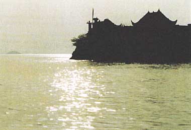
Photo: Chinese Research Academy of Environmental Scienes
A. LOCATION
- Anhui Province, P.R. China.
- 30:25-31:43N, 117:17-117:52E.
B. DESCRIPTION
Lake Chao is located 15 km southeast from Hefei City, the capital of Anhui Province. It is one of the five largest freshwater lakes in China, and is the largest lake in the Province. The life of the lake is about 10 thousand years.
The lake is famous for its beautiful landscape and historic sites, and is extensively used as water sources for drinking, irrigation, fishery and transportation. About 5 million people live around the lake. In 1962, a dam was built at the only outflowing river. Control of water level has brought about some merits for irrigation and transportation, but at the same time it resulted in some demerits. The most evident effect was the reduction of fish production.
Owing to the rapid development of industry, fast increase of population and establishment of water conservancy facilities, the lake has suffered from eutrophication and silting in recent years (Q).
C. PHYSICAL DIMENSIONS (Q)
| Surface area [km2] | 756 |
| Volume [km3] | 1.7 |
| Mean depth [m] | 7.5-7.8 |
| Water level | Regulated |
| Length of shoreline [km] | 185 |
| Catchment area [km2] | 10,430 |
D. PHYSIOGRAPHIC FEATURES
D1 GEOGRAPHICAL (Q)
- Names of main islands: Laoshan (0.86 km2).
- Number of outflowing rivers and channels (name): 1 (Yuxi R.).
D2 CLIMATIC
| | Jan | Feb | Mar | Apr | May | Jun |
Jul | Aug | Sep | Oct | Nov | Dec | Ann. |
|---|
| Mean temp. [deg C] | | 2-3 | - | - | - | - |
- | 28-30 | - | - | - | - | - | 15-16 |
| Dec-Jan-Feb | Mar-Apr-May | Jun-Jul-Aug | Sep-Oct-Nov | Ann. |
|---|
| Precipitation [mm] | 121 | 308 | 429 | 231 | 1,100 |
- Water temperature [deg C], 1982-1984
| Depth[m] | Jan | Feb | Mar | Apr | May | Jun |
Jul | Aug | Sep | Oct | Nov | Dec |
|---|
| 0 | - | 5.2 | - | - | 24.4 |
- | - | 32.1 | - | - | 19.1 | - |
E. LAKE WATER QUALITY (Q)
E1 TRANSPARENCY [m]
1982-1984
| Depth[m] | Jan | Feb | Mar | Apr | May | Jun |
Jul | Aug | Sep | Oct | Nov | Dec |
|---|
| - | 0.133 | - | - | 0.153 |
- | - | 0.18 | - | - | 0.179 | - |
E2 pH
1982-1984
| Depth[m] | Jan | Feb | Mar | Apr | May | Jun |
Jul | Aug | Sep | Oct | Nov | Dec |
|---|
| 0 | - | 7.57 | - | - | 7.81 | - |
- | 8.09 | - | - | 8.18 | - |
E4 DO [mg l-1]
1982-1984
| Depth[m] | Jan | Feb | Mar | Apr | May | Jun |
Jul | Aug | Sep | Oct | Nov | Dec |
|---|
| 0 | - | 12.12 | - | - | 7.93 | - |
- | 6.09 | - | - | 10.13 | - |
E5 COD [mg l-1]
1982-1984
| Depth[m] | Jan | Feb | Mar | Apr | May | Jun |
Jul | Aug | Sep | Oct | Nov | Dec |
|---|
| 0 | - | 3.75 | - | - | 4.38 | - |
- | 4.36 | - | - | - | - |
E6 CHLOROPHYLL CONCENTRATION [micro g l-1]
1982-1984
| Depth[m] | Jan | Feb | Mar | Apr | May | Jun |
Jul | Aug | Sep | Oct | Nov | Dec |
|---|
| 0 | - | 3.75 | - | - | 4.38 | - |
- | 4.36 | - | - | - | - |
E7 NITROGEN CONCENTRATION [mg l-1]
| Depth[m] | Jan | Feb | Mar | Apr | May | Jun |
Jul | Aug | Sep | Oct | Nov | Dec |
|---|
| 0 | - | 2.37 | - | - | 1.70 | - |
- | 0.91 | - | - | 1.58 | - |
E8 PHOSPHORUS CONCENTRATION [mg l-1]
| Depth[m] | Jan | Feb | Mar | Apr | May | Jun |
Jul | Aug | Sep | Oct | Nov | Dec |
|---|
| 0 | - | 0.155 | - | - | 0.144 | - |
- | 0.097 | - | - | 0.144 | - |
F. BIOLOGICAL FEATURES (Q)
F1 FLORA
- Phytoplankton
Winter-spring Microcystis aeruginosa, M. flos-aquae, Anabaena spiroides, Aphanizomenon flos- aquae. Summer-fall: Cyclotella comta, Melosira islandica, Eudorina elegans.
F5 FISHERY PRODUCTS
- Annual fish catch [metric tons]
1980: 3,000.
G. SOCIO-ECONOMIC CONDITIONS (Q)
G1 LAND USE IN THE CATCHMENT AREA
| 1984 |
| Area [km2] | [%] |
|---|
| Natural landscape |
| - Woody vegetation | 706 | 6.8 |
| - Herbaceous vegetation | 1,130 | 10.8 |
| Agricultural land |
| - Crop field | 6,480 | 62.1 |
| Others | 2,115 | 20.3 |
| Total | 10,430 | 100 |
- Main kinds of crops: Rice, wheat.
- Levels of fertilizer application on crop fields: Heavy.
G3 POPULATION IN THE CATCHMENT AREA
| Population | Population density [km-2] | Major cities (population) |
|---|
| Urban | 970,000 | | Hefei |
| Rural | 4,360,000 |
| Total | 5,330,000 | 583 |
H. LAKE UTILIZATION
H1 LAKE UTILlZATlON (Q)
Source of water, navigation and transportation, sightseeing and tourism,
fisheries.
H2 THE LAKE AS WATER RESOURCE : No information.
I. DETERIORATION OF LAKE ENVIRONMENTS AND HAZARDS (Q)
I1 ENHANCED SILTATlON
- Extent of damage: Serious.
I2 TOXIC CONTAMINATION
- Present status: Detected but not serious.
- Main contaminants, their concentrations and sources
| Name of contaminants | Range of concentrations [ppm] in | Water Bottom mud |
Fish | Other organisms | Main | Sources |
|---|
| (1982) |
|---|
| Hg | - | 0.132 | - | - | Weathering of rock |
| As | - | 11.21 | - | - | Industrial sewage |
| Cu | - | 19.04 | - | - |
| Zn | - | 76.65 | - | - |
| Pb | - | 34.51 | - | - |
I3 EUTROPHICATION
- Nitrogen and phosphorus loadings to the lake [t yr-1]
| 1982 |
| Sources | Industrial | Domestic | Agricultural | Natural | Total |
|---|
| T-N | N.A. | 3,540.5 | N.A. | 275.88 | N.A. |
| T-P | N.A. | 177 | N.A. | 15.05 | N.A. |
I4 ACIDIFICATION
- Extent of damage: No information.
J. WASTEWATER TREATMENTS (Q)
J1 GENERATION OF POLLUTANTS IN THE CATCHMENT AREA
e) Severe pollution with no wastewater treatment.
J3 SANITARY FACILITIES AND SEWERAGE : No treatment system.
K. IMPROVEMENT WORKS IN THE LAKE
K3 OTHERS (Q)
The following measures are being planned.
- For soil erosion control, the whole catchment will be divided into several subregions which are to be managed by different technological, biological and agricultural schemes.
- The total pollutant loads to the lake will be controlled.
- Necessary rules and regulations for environmental protection will be strengthened.
M. LEGISLATIVE AND INSTITUTIONAL MEASURES FOR UPGRADING LAKE ENVIRONMENTS (Q)
M1 NATIONAL AND LOCAL LAWS CONCERNED: No information.
M2 INSTITUTIONAL MEASURES: No information.
N. SOURCES OF DATA
- Questionnaire filled by Prof. Liu Hongliang, Chinese Research Academy of Environmental Sciences, Beijing.

