
LAKE VOLVI
A view from the southern shore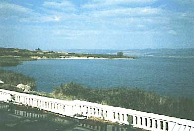
Photo: A. Kurata
A. LOCATION
- Macedonia; and Greece.
- 40:37-40:41N, 23:21-23:36E; 37 m above sea level.
B. DESCRIPTION
-
Lake Volvi is one of the numerous Macedonian lakes in northern Greece, and is located about 40 km northeast from the city of Thessaloniki. The catchment is mostly barren, mainly used for grazing except a small portion under cultivation, and without any urban or industrial development. Some dry rivers drain the catchment area, while a small stream is the only outflow. There are times when the lake receives water from a neighboring lake, Koronia.
The Lake Volvi area is characterized by a mild Mediterranean climate with rainy warm winters and dry hot summers. The lake never freezes over in winter. The precipitation is the largest in November - December and the least in August. High floods may sometimes occur by unusual heavy rainfall, in contrast to severe droughts when minimum inflow reaches the lake.
Lake Volvi is a warm monomictic lake with thermal and chemical stratification established in May. During the stratification period, the epilimnion is about 11 m thick and microstratifications develop within it. By September, the overturn is initiated and isothermal conditions prevail in winter and early spring. The maximum surface water temperature is measured in August and the minimum in February. The concentration of oxygen in the epilimnion ranges approximately from 8 to 10 mg l-1 and the maximum concentration is recorded during the isothermal conditions. During the stratification period the hypolimnion is devoid of oxygen.
Recently, blue-green algal blooms have been observed in early summer after a very dry period when the external input of nutrients decreases significantly. Therefore, it is concluded that the nitrogen fixation by N2-fixing cyanophytes and the release of ammonia nitrogen, phosphorus and silica from the anoxic sediment may be the most important sources of nutrient supply in this lake during the dry, warm period when the highest phytoplankton biomass is developed (1, 2).
C. PHYSICAL DIMENSIONS
| Surface area [km2] | 67 |
| Maximum depth [m] | 23 |
| Mean depth [m] | 13.5 |
| Water level | Unregulated |
| Catchment area [km2] | 1,247 |
D. PHYSIOGRAPHIC FEATURES
D1 GEOGRAPHICAL- Bathymetric map: Fig. EUR-40-01.
- Names of main islands: None.
- Number of outflowing rivers and channels (name): 1 (unknown).
- Climatic data at Thessaloniki, 1931-1960
| Mean temp. [deg C] | ||||||||||||
| Jan | Feb | Mar | Apr | May | Jun | Jul | Aug | Sep | Oct | Nov | Dec | Ann. |
|---|---|---|---|---|---|---|---|---|---|---|---|---|
| 5.5 | 7.1 | 9.6 | 14.5 | 19.6 | 24.7 | 27.3 | 26.8 | 22.5 | 17.1 | 12.0 | 7.5 | 16.1 |
| Precipitation [mm] | ||||||||||||
| 44 | 34 | 35 | 36 | 40 | 33 | 20 | 14 | 28 | 55 | 56 | 54 | 449 |
- Number of hours of bright sunshine (Athens): 2,655 hr yr-1.
Bathymetric map [m](1).
- Water temperature [deg C](1)
| Station A, April 1985-March 1986 | |||
| Depth [m] | Min | Max | Ann. |
|---|---|---|---|
| S*1 | 6.9 | 27.0 | 17.5 |
| B*2 | 6.7 | 22.0 | 14.8 |
| *1 Surface. *2 Bottom. | |||
- Freezing period: None.
- Mixing type: Monomictic.
E. LAKE WATER QUALITY
E1 TRANSPARENCY [m](1)| Station A, April 1985-March 1986 | |||
| Depth [m] | Min | Max | Ann. |
|---|---|---|---|
| 0.7 | 2.4 | 1.6 | |
| Station A, April 1985-March 1986 | |||
| Depth [m] | Min | Max | Ann. |
|---|---|---|---|
| 8.0 | 9.3 | 8.5 | |
| * Whole water column. | |||
Seasonal variation of transparency (a) and pH (b)(2).
E4 DO [mg l-1](1)
| Station A*, April 1985-March 1986 | |||
| Depth [m] | Min | Max | Ann. |
|---|---|---|---|
| Surface | 8.4 | 11.7 | 9.6 |
| Bottom | 0.0 | 11.2 | 5.5 |
| * Whole water column. | |||
- NH4-N [mg l-1]
| Station A*, April 1985-March 1986 | |||
| Depth [m] | Min | Max | Ann. |
|---|---|---|---|
| 0.003 | 0.109 | 0.448 | |
| * Whole water column. | |||
Vertical and seasonal distribution of NH4-N concentration [micro g l-1](2).
- NO2-N [mg l-1]
| Station A*, April 1985-March 1986 | |||
| Depth [m] | Min | Max | Ann. |
|---|---|---|---|
| 0.0 | 0.057 | 0.006 | |
- NO3-N [mg l-1]
| Station A*, April 1985-March 1986 | |||
| Depth [m] | Min | Max | Ann. |
|---|---|---|---|
| 0.001 | 0.197 | 0.045 | |
Vertical and seasonal distribution of NO3-N concentration [micro g l-1](2).
E8 PHOSPHORUS CONCENTRATION (1)
- PO4-P [mg l-1]
| Station A*, April 1985-March 1986 | |||
| Depth [m] | Min | Mix | Ann. |
|---|---|---|---|
| 0.002 | 0.008 | 0.004 | |
| * Whole water column. | |||
Vertical and seasonal distribution of PO4-P concentration [micro g l-1](2).
F. BIOLOGICAL FEATURES
F1 FLORA (1)- Phytoplankton
Cyanophyta (Anabaena aphanizomenoides, A. circinalis, A. flos-aquae, Anabaenopsis circularis, Aphanocapsa delicatissima, Aphanothece clathrata, Chroococcus limneticus, Coelosphaerium kuetzingianum, C. minutissimum, Cyanocatena planctonica, Cyanogranis ferruginea, Cylindrospermopsis raciborskii, Lyngbya circumcreta, L. limnetica, Merismopedia punctata, M. tenuissima, Microcystis aeruginosa, M. incerta, Oscillatoria limnetica, O. subtilissima, Pseudanabaena limnetica, Radiocystis geminata), Chlorophyta (Actinastrum hantzschii, Coelastrum astroideum, C. microporum, Coenococcus polycoccus, Coronastrum lunatum, Crucigenia tetrapedia, Crucigeniella apiculata, Dichotomococcus curvatus, Dictyosphaerium pulchellum, D. tetrachotomum, Didymocystis planctonica, Didymogenes palatina, Elakatothrix genevensis, Franceia ovalis, Kirchneriella lunaris, Koliella longiseta, K. planctonica, Lagerheimia ciliata, L. genevensis, Micractinium pusillum, Monoraphidium arcuatum, M. contortum, M. griffithii, Nephrochlamys willeana, Nephrocytium lunatum, Oocystis lacustris, O. marssonii, Pediastrum boryanum, P. duplex, P. simplex, P. tetras, Planktosphaeria gelatinosa, Quadricoccus ellipticus, Scenedesmus acuminatus, S. alternans, S. ecornis, S. intermedius, S. opoliensis, Tetraedron caudatum, T. minimum, Tetrastrum heteracanthum, Closterium aciculare, C. acutum, Cosmarium depressum), Euglenophyta (Euglena sp.), Chrysophyta (Cyclotella sp., Melosira granulata, Rhizosolenia longiseta, Stephanodiscus hantzschii, S. rotula, Nitzschia acicularis, Synedra acus, S. ulna, Mallomonas sp.), Dinophyta (Ceratium hirundinella, Gymnodinium spp.), Cryptophyta (Rhodomonas minuta), Haptophyta (Chrysochromulina cf. parva).
- Zooplankton
Daphnia cucullata, Bosmina longirostris, Polyarthra sp., Keratella sp.
Changes in the number of species belonging to the most numerous algal classes and the total number of phytoplankton species (2).
Annual cycles of cyanophytes, diatoms, cryptophytes, chlorophytes, dinoflagellates and haptophytes in the lake (2).
F4 BIOMASS (1)
- Phytoplankton* [mg m-3]
| 1985-1986 | ||||||||
| Bac | Cryp | Cyan | Din | Chl | Hapt | Chr | Total biomass | |
|---|---|---|---|---|---|---|---|---|
| Mar | 1,580 | 581 | 2 | 0 | 164 | 0 | 33 | 2,360 |
| Apr | 261 | 977 | 0 | 0 | 133 | 0 | 29 | 1,400 |
| May | 0 | 833 | 45 | 55 | 10 | 30 | 53 | 1,026 |
| Jun | 45 | 19 | 689 | 248 | 112 | 68 | 0 | 1,181 |
| Jul | 258 | 249 | 1,606 | 160 | 5 | 51 | 0 | 2,329 |
| Aug | 127 | 31 | 1,943 | 59 | 0 | 7 | 0 | 2,167 |
| Sep | 1,201 | 355 | 1,200 | 59 | 21 | 7 | 0 | 2,843 |
| Oct | 1,738 | 389 | 466 | 0 | 35 | 15 | 0 | 2,643 |
| Nov | 331 | 267 | 106 | 136 | 0 | 0 | 0 | 840 |
| Dec | 359 | 556 | 0 | 0 | 88 | 2 | 0 | 1,005 |
| Jan | 162 | 884 | 1 | 0 | 73 | 0 | 3 | 1,123 |
| Feb | 1,096 | 1,254 | 1 | 13 | 134 | 3 | 10 | 2,511 |
| Mar | 622 | 306 | 5 | 24 | 47 | 0 | 3 | 1,007 |
| * Monthly mean. | ||||||||
Seasonal variation of phytoplankton biomass (1).
Percentage contribution of the different algal groups to the total phytoplankton biomass (1).
G. SOCIO-ECONOMIC CONDITIONS (1, 3)
G1 LAND USE IN THE CATCHMENT AREA 1988-
Mostly barren area used for grazing, only a small portion is cultivated.
- Main types of woody vegetation: Oak, fruit gardens.
- Main kinds of crops: Wheat, maize, barley.
- Levels of fertilizer application on crop fields: Moderate.
-
1988: None.
H. LAKE UTILIZATION (1, 3)
H1 LAKE UTILIZATION-
Sight-seeing and tourism, and recreation.
I. DETERIORATION OF LAKE ENVIRONMENTS AND HAZARDS
I1 ENHANCED SILTATION (1, 3)- Extent of damage: None.
- Present status: None.
- Nuisance caused by eutrophication: Slight algal bloom.
- Extent of damage: None.
J. WASTEWATER TREATMENTS (1, 3)
J1 GENERATION OF POLLUTANTS IN THE CATCHMENT AREA-
b) No sources of significant pollution.
-
None.
K. IMPROVEMENT WORKS IN THE LAKE (1, 2)
-
None.
L. DEVELOPMENT PLANS (1, 2)
-
None.
N. SOURCES OF DATA
- Moustaka-Gouni, M. T. (1988) Arch. Hydrobiol., 112: 251-264.
- --- & Tsekos, I. (1989) Arch. Hydrobiol., 115: 575-588.
- The editor's observation.
