
MASSAWIPPI LAKE
A view on the lakeshore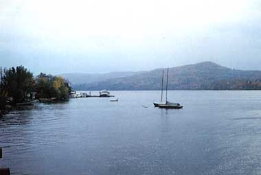
Photo: J.Dupont
A. LOCATION
- Quebec, Canada.
- 45:0-45:7N, 71:8-72:4W; 160.8 m above sea level.
B. DESCRIPTION
From the morphometric point of view, Lake Massawippi is a lake of which the maximum and average depth are very large. The dissolved mineral content is high compared to other Quebec lakes and even elevated compared to lakes of the Eastern Townships. The specific conductivity, for example, ranges from 120 to 230 micro S cm-1 and the waters are dominated by HCO3- (64-72 mg l-1) and Ca (26-35 mg l-1). The general geology of the Lake Massawippi watershed consists of two lithology groups. Calcareous fine to coarse-grained clastic sedimentary rocks are found on the southwest of the lake, while non-calcareous siliceous sedimentary rocks characterize the northwest portion of the watershed. It is a dimictic lake. The temporal variations in the percentage saturation of dissolved oxygen at the bottom of the lake (deep zone) are characteristic of a mesotrophic lake. One notes in effect, a percentage of oxygen saturation at the bottom of the order of 50% in August. The concentrations of phosphorus and nitrogen are elevated and it could be assumed that these waters are productive. The parameters of the primary production are high at the south end of the lake and show medium values in the zone of the outlet of the lake. In addition, the transparency of the water of this lake is in the mesotrophic range (4-6 m).In the immediate environment, 71% of the perimeter of the lake have been strongly affected, above all by the following criteria: cottages too close to the lake, railway bordering the beach of the lake and excessive clearing of trees. 21% of the perimeter of the lake have not yet been touched.
The catchment basin of the lake is only 46% wooded and agriculture occupies a bit more than 44% of the area of the basin. The rest is in a zone of leisure and urban development.
The amount of phosphorus received annually by Lake Massawippi surpasses theoretically the dangerous limit, above which accelerated eutrophication can be expected. Of all the total input more than 54% comes from the animal population. Agricultural husbandry contributes enormously to the eutrophication of the lake. The spreading of chemical fertilizers as well as the animal population contribute more than 75% of the total input to the lake. The natural input constitutes only 16% of all the total input. The effect of this input seems to make itself felt in the southwest section of the lake receiving the principal load of phosphorus.
Eutrophication of the southwest part of Massawippi
Lake has been accelerating for the past several years due to various human
activities in the environment near the lake and in a developing sector
of its drainage basin (1, Q).
C. PHYSICAL DIMENSIONS
| Surface area [km2] | 18 |
| Volume [km3] | 0.745 |
| Maximum depth [m] | 85.7 |
| Mean depth [m] | 41.6 |
| Water level | Regulated |
| Length of shoreline [km] | 38.3 |
| Residence time [yr] | 1.5 |
| Catchment area [km2] | 586 |
D. PHYSIOGRAPHIC FEATURES
D1 GEOGRAPHICAL
- Bathymetric map: Fig. NAM-49-01.
- Number of outflowing rivers and channels (name): 1 (Massawippi R.).
D2 CLIMATIC
- Climatic data at Bonsecours*, 1951-1980 (2)
| Jan | Feb | Mar | Apr | May | Jun | Jul | Aug | Sep | Oct | Nov | Dec | Ann. | |
|---|---|---|---|---|---|---|---|---|---|---|---|---|---|
| Mean temp. [deg C] | -11.5 | -10.4 | -3.9 | 3.6 | 10.6 | 15.8 | 18.2 | 16.8 | 12.5 | 6.8 | 0.2 | -8.4 | 4.2 |
| Precipitation [mm] | 75 | 68 | 85 | 91 | 96 | 96 | 123 | 134 | 97 | 93 | 95 | 84 | 1,136 |
- Number of hours of bright sunshine (Sherbrooke*): 1,900 hr yr-1.
- Solar radiation (Montreal Jean Brebeuf)[MJ m-2 day-1]
* 120 km west of the lake.
| Jan | Feb | Mar | Apr | May | Jun | Jul | Aug | Sep | Oct | Nov | Dec | Ann. |
|---|---|---|---|---|---|---|---|---|---|---|---|---|
| 5.30 | 8.80 | 12.51 | 15.87 | 19.07 | 20.25 | 20.96 | 17.23 | 13.45 | 8.04 | 4.61 | 3.92 | 12.5 |
Fig. NAM-49-01
Bathymetric map [40 ft=12.2 m](Q).

- Water temperature [deg C]
| Depth [m] | Jan | Feb | Mar | Apr | May | Jun | Jul | Aug | Sep | Oct | Nov | Dec |
|---|---|---|---|---|---|---|---|---|---|---|---|---|
| 1 | - | 2 | - | 5.6 | - | - | - | 24.5 | - | - | 10.7 | - |
| 5 | - | - | - | - | - | - | - | 22.5 | - | - | - | - |
| 8 | - | - | - | - | - | - | - | 17.0 | - | - | - | - |
| 10 | - | - | - | - | - | - | - | 11.9 | - | - | - | - |
| 12 | - | - | - | - | - | - | - | 9.4 | - | - | - | - |
| 15 | - | - | - | - | - | - | - | 8.3 | - | - | - | - |
| 20 | - | - | - | - | - | - | - | 7.5 | - | - | - | - |
| 30 | - | - | - | - | - | - | - | 6.1 | - | - | - | - |
| 40 | 4.1 | - | - | - | - | - | - | - | - | - | 5.1 | - |
| 84* | 4.3 | - | - | 3.9 | - | - | - | 4.6 | - | - | 4.4 | - |
- Freezing period: December-April.
- Mixing type: Dimictic.
E. LAKE WATER QUALITY
E1 TRANSPARENCY [m]
| Jan | Feb | Mar | Apr | May | Jun | Jul | Aug | Sep | Oct | Nov | Dec |
|---|---|---|---|---|---|---|---|---|---|---|---|
| - | - | - | - | 4.0 | - | - | 4.0 | - | - | - | 6.0 |
E2 pH
| Depth [m] | Jan | Feb | Mar | Apr | May | Jun | Jul | Aug | Sep | Oct | Nov | Dec |
|---|---|---|---|---|---|---|---|---|---|---|---|---|
| S*1 | - | - | 7.6 | - | 7.0 | - | - | 8.9 | - | 8.0 | - | - |
| 1 | - | - | - | - | 6.6 | - | - | 8.6 | - | 7.8 | - | - |
| 3 | - | - | - | - | - | - | 8.6 | - | - | - | - | |
| 5 | - | - | - | - | - | - | - | 8.4 | - | - | - | - |
| 7 | - | - | - | - | - | - | - | 8.3 | - | - | - | - |
| 8 | - | - | - | - | - | - | - | 7.9 | - | - | - | - |
| 9 | - | - | - | - | - | - | - | 6.7 | - | - | - | - |
| 10 | - | - | - | - | - | - | - | 6.5 | - | - | - | - |
| 11 | - | - | - | - | - | - | - | 6.6 | - | - | - | - |
| 12 | - | - | - | - | - | - | - | 6.6 | - | - | - | - |
| 20 | - | - | - | - | - | - | - | 6.8 | - | - | - | - |
| 30 | - | - | - | - | 6.4 | - | - | - | - | - | - | - |
| 40 | - | - | - | - | - | - | - | 7.0 | - | 7.0 | - | - |
| 50 | - | - | - | - | - | - | - | 7.0 | - | - | - | - |
| 70 | - | - | - | - | - | - | - | 7.0 | - | - | - | - |
| 84*2 | - | - | - | - | 6.3 | - | - | 7.0 | - | 6.9 | - | - |
E3 SS [mg l-1]
| Depth [m] | Jan | Feb | Mar | Apr | May | Jun | Jul | Aug | Sep | Oct | Nov | Dec |
|---|---|---|---|---|---|---|---|---|---|---|---|---|
| S* | - | - | - | - | 1.0 | - | - | 1.0 | - | - | 2.0 | - |
E4 DO [mg l-1]
| Depth [m] | Jan | Feb | Mar | Apr | May | Jun | Jul | Aug | Sep | Oct | Nov | Dec |
|---|---|---|---|---|---|---|---|---|---|---|---|---|
| 1 | - | 11.4 | - | - | 10.9 | - | - | 9.7 | - | - | 8.9 | - |
| 3 | - | - | - | - | - | - | - | 9.7 | - | - | - | - |
| 5 | - | - | - | - | - | - | - | 9.5 | - | - | - | - |
| 7 | - | - | - | - | - | - | - | 9.3 | - | - | - | - |
| 8 | - | - | - | - | - | - | - | 8.0 | - | - | - | - |
| 9 | - | - | - | - | - | - | - | 8.1 | - | - | - | - |
| 10 | - | - | - | - | - | - | - | 8.2 | - | - | - | - |
| 11 | - | - | - | - | - | - | - | 8.4 | - | - | - | - |
| 12 | - | - | - | - | - | - | - | 8.5 | - | - | - | - |
| 15 | - | - | - | - | - | - | - | 8.8 | - | - | - | - |
| 20 | - | - | - | - | - | - | - | 9.2 | - | - | - | - |
| 35 | - | 7.0 | - | - | - | - | - | - | - | - | - | - |
| 40 | - | - | - | - | 10.8 | - | - | 9.8 | - | - | 8.5 | - |
| 60 | - | - | - | - | - | - | - | 9.5 | - | - | - | - |
| 80* | - | 5.0 | - | - | 9.3 | - | - | 7.4 | - | - | 8.5 | - |
E5 COD [mg l-1]
| Depth [m] | Jan | Feb | Mar | Apr | May | Jun | Jul | Aug | Sep | Oct | Nov | Dec |
|---|---|---|---|---|---|---|---|---|---|---|---|---|
| S*1 | - | 3.2 | - | - | 3.2 | - | - | 4.0 | - | 2.8 | - | - |
| 80*2 | - | - | - | - | - | - | - | 3.0 | - | - | - | - |
Method used: Cobalt oxide.
E6 CHLOROPHYLL CONCENTRATION [micro l-1]
| Depth [m] | Jan | Feb | Mar | Apr | May | Jun | Jul | Aug | Sep | Oct | Nov | Dec |
|---|---|---|---|---|---|---|---|---|---|---|---|---|
| S* | - | - | - | - | - | - | - | 4.9 | - | - | - | - |
E7 NITROGEN CONCENTRATION
- Total Kjeldahl-N + NO3-N [mg l-1]
| Depth [m] | Jan | Feb | Mar | Apr | May | Jun | Jul | Aug | Sep | Oct | Nov | Dec |
|---|---|---|---|---|---|---|---|---|---|---|---|---|
| S*1 | - | 0.67 | - | - | 0.65 | - | - | 0.34 | - | 0.58 | - | - |
| 80*2 | - | - | - | - | - | - | - | 0.70 | - | - | - | - |
E8 PHOSPHORUS CONCENTRATION
- Total-P [mg l-1]
| Depth [m] | Jan | Feb | Mar | Apr | May | Jun | Jul | Aug | Sep | Oct | Nov | Dec |
|---|---|---|---|---|---|---|---|---|---|---|---|---|
| S* | - | .007 | - | - | .030 | - | - | <.007 | - | - | <.007 | - |
E9 CHLORIDE CONCENTRATION [mg l-1]
| Depth [m] | Jan | Feb | Mar | Apr | May | Jun | Jul | Aug | Sep | Oct | Nov | Dec |
|---|---|---|---|---|---|---|---|---|---|---|---|---|
| S | - | 6.0 | - | - | 7.0 | - | - | 8.0 | - | - | 9.0 | - |
| 80* | - | - | - | - | - | - | - | 8.0 | - | - | - | - |
F. BIOLOGICAL FEATURES
F1 FLORA (Q)
- Emerged macrophytes
- Floating macrophytes: Nuphar variegatum.
- Submerged macrophytes
- Phytoplankton
Eleocharis sp., Pontederia cordata, Scirpus validus, Typha latifolia, Equisetum littorale, Sparganium chlorocarpum.
Myriophyllum exalbescens, Najas flexilis, Potamogeton amplifolius, P.
pusillus, P. richardsonii, P. robinsii, Elodea canadensis.
Bacillariophyceae (June-August), Cryptophyceae (May-July), Chrysophyceae (June), Chlorophyceae (May).
F2 FAUNA (Q)
- Fish*1
Perca flavescens, Ambloplites rupestris, Catostomus commersoni, C. catostomus, Notemigonus crysolencas, Coregonus carinatum, Moxostoma carinatum, Micropterus dolomieui, Lepomis gibbosus, Ictaleurus nebulosus, Moxostoma anisurum, Salmo trutta*2, Salvelinus namaycush*2, Esox lucius*2.
*1 In order of relative abundance. *2 Economically important.
F5 FISHERY PRODUCTS
- No commercial fishing, only sport-fishing.
G. SOCIO-ECONOMIC CONDITIONS
G1 LAND USE IN THE CATCHMENT AREA
| Area [km2] | [%]* | |
|---|---|---|
| Watershed located in Canada | 498.3 | |
| in USA | 105.9 | |
| Natural landscape | ||
| - Woody vegetation | 231.2 | 46.4 |
| - Herbaceous vegetation | 28.9 | 5.8 |
| - Swamp | 0.3 | <0.1 |
| Agricultural land | ||
| - Crop field | 170.0 | 34.1 |
| - Pasture land | 53.8 | 2.1 |
| Others | 4.0 | 0.8 |
| Total | 498.3 | 100.0 |
- Types of important forest vegetation: Maple, yellow birch, spruce.
- Main kinds of crops and/or cropping systems: Corn, cereal, vegetables.
- Levels of fertilizer application on crop fields: Moderate
G2 INDUSTRIES IN THE CATCHMENT AREA AND THE LAKE (3)
| Main products or major industries | |
|---|---|
| Primary industry | Agriculture |
| Secondary industry | Manufacturing, construction |
| Tertiary industry | Various service industries |
- Numbers of domestic animals in the catchment area
Cattle 19,336, sheep 5,166, swine 10,980, poultry 316,114.
G3 POPULATION IN THE CATCHMENT AREA (Canadian part)(4)
| Population | Population density [km-2] | Major cities (population) | |
|---|---|---|---|
| Total | 3,850*1 (2,180)*2 | 7.7 | None |
H. LAKE UTILIZATION
H1 LAKE UTILIZATION
- Source of water, sightseeing and tourism, and recreation (swimming,
sport- fishing, yachting, and high speed boat racing).
H2 THE LAKE AS WATER RESOURCE
| Use rate [m3 sec-1] | |
|---|---|
| Domestic | N.A. |
I. DETERIORATION OF LAKE ENVIRONMENTS AND HAZARDS
I1 ENHANCED SILTATION
- Extent of damage: Not serious.
I2 TOXIC CONTAMINATION
- Present status: Detected but not serious.
- Main contaminants, their concentrations and sources
| Name of contaminant | Concentration [mg kg-1] Fish* | Main sources |
|---|---|---|
| Mercury | 0-1.59 | Natural |
- Food safety standards for toxic contaminant residue
Hg 0.5 [mg kg-1].
I3 EUTROPHICATION
- Nuisance caused by eutrophication
- Nitrogen and phosphorus loadings to the lake [kg yr-1]
Unusual algal bloom: Bacillariophyceae and Chrysophyceae.
| Sources | Domestic | Agricultural | Natural | Total |
|---|---|---|---|---|
| T-P | 2,780 | 25,220 | 5.340 | 33,340 |
- Supplementary notes
No known program implemented to control agricultural inputs.
I4 ACIDIFICATION
- Extent of damage: None.
I5 OTHER HAZARDS
- Shore arrangement and management is deficient in 73% of the total length
of shore. 7% is well arranged while 21% of the shores are in their natural
state. The Lake Massawippi Water Protection Group has put pressure on the
railroad authorities (the railroad follows the north side of the lake)
to remove slags that have been brought from Thedford Mines. These materials
were containing high concentrations of Asbestos fibres. According to John
Rasmussen (President of the Group), they were able to change this practice.
J. WASTEWATER TREATMENTS
J1 GENERATION OF POLLUTANTS IN THE CATCHMENT AREA
- (c) Limited pollution with wastewater treatment.
J2 APPROXIMATE PERCENTAGE DISTRIBUTION OF POLLUTANT LOADS
| [%] | |
|---|---|
| Non-point sources
(agricultural, natural and dispersed settlements) |
92.4 |
| Point sources
(municipal) |
7.6 |
J3 SANITARY FACILITIES AND SEWERAGE
- Municipal wastewater treatment systems
No. of secondary treatment systems: 2 (aerated lagoon in North Hatley and activated sludge+chlorination in Ayer's Cliff).
K. IMPROVEMENT WORKS IN THE LAKE
- None.
L. DEVELOPMENT PLANS
- No development plans around the lake. No data for the rest of the catchment.
M. LEGISLATIVE AND INSTITUTIONAL MEASURES FOR UPGRADING LAKE ENVIRONMENTS
M1 NATIONAL AND LOCAL LAWS CONCERNED
- Names of the laws (the year of legislation)
- Law related to the quality of the environment of the Quebec Provincial Government
- Responsible authorities
- Quebec Ministry of the Environment
M2 INSTITUTIONAL MEASURES
- Ministry of Environment, Quebec City
- Massawippi Water Protection Inc., North Hatley (Quebec)
M3 RESEARCH INSTITUTES ENGAGED IN THE LAKE ENVIRONMENT STUDIES
- Biology Department, Sherbrooke University
N. SOURCES OF DATA
- Questionnaire filled by Dr. J. Dupont, Ministry of Environment, Government of Quebec, Canada.
- Government of Quebec, Ministry of Natural Resources (1978) Limnological Study, Lake Massawippi, Quebec.
- Canadian Climate Normals, 1951-1980. Environment Canada, Atmospheric Environment Service.
- Statistics Canada, Census of Canada, 1981. Population Economic Characteristics of Quebec, Vol. 2, pt. 6, > 5. Ottawa.
- Statistics Canada (1987) Census of Canada, 1986. Profile Series. Census Division & Sub-divisions, Ottawa.
