
MIQUELON LAKE
A view on the lakeshore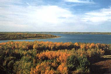
Photo: S.Allen
A. LOCATION
- Alberta, Canada.
- 53:1N, 112:5W; 763.1 m above sea level.
B. DESCRIPTION
Miquelon Lake is a shallow body of saline water located within the county of Camrose in central Alberta, about 40 km southeast of the city of Edmonton. It lies on the southern edge of the Cooking Lake moraine. The lake was once part of a considerably larger lake that receded and left three isolated basins, the largest of which is called "Miquelon Lake".Miquelon Lake is representative of a large group of inland saline lakes that are scattered throughout the three prairie provinces (Manitoba, Saskatchewan and Alberta). Sulphate concentrations are relatively high and nutrient concentrations are extremely high. In contrast, phytoplankton and rooted macrophyte biomass are relatively low. Many of the moderately saline lakes are ideal for contact recreation, although they have a poor (if any) recreational fishery.
Miquelon Lake has been used for recreation by local residents since the turn of the century, especially after a railway line was established between Camrose and Tofield in 1909. The nearby hamlet of Kingman became known as the "Gateway to Miquelon". The access and facilities at the lake were greatly improved when Miquelon Lake Provincial Park was established in 1958. The park provides facilities for swimming, boating, camping and picnicking. Much of the land surrounding the three basins is a wildlife sanctuary which provides nature-viewing opportunities.
Presently, Miquelon Lake is heavily used for recreation,
especially on warm sunny weekends. Game fish are no longer present in the
lake but the beach area at the provincial park is generally clean and attractive
for swimming.
The saline water tends to inhibit the growth of algae and the lake
is often very clear.
There has been no surface outflow from Miquelon
Lake since the 1920's. Drainage may have been toward the North Saskatchewan
River through the moraine although there is geological evidence that the
formerly large lake drained south toward the Battle River. In recent times
(1927) southward flow occurred only after the outlet creek at the southern
basin was deepened to divert water for the town of Camrose water supply.
The flow in the diversion ditch ran only about three years even though
the ditch was deepened when flow declined. The water level in the lake
has declined considerably since then, separating the three basins. Many
local residents blame the diversion for the drastic decline in water level
in Miquelon Lake, but Woodburn suggests that this had a minor effect in
comparison to climatic factors. The outlet canal has been blocked for many
years (1, 2, 3, 4).
C. PHYSICAL DIMENSIONS (5, 6)
| Surface area [km2] | 9 |
| Volume [km3] | 0.02374 |
| Maximum depth [m] | 6 |
| Mean depth [m] | 2.7 |
| Water level | Unregulated |
| Length of shoreline [km] | 19.5 |
| Residence time [yr]* | |
| Catchment area [km2] | 35 |
D. PHYSIOGRAPHIC FEATURES
D1 GEOGRAPHICAL
- Bathymetric map: Fig. NAM-46-01.
- Names of main islands: None.
- Number of outflowing rivers and channels (name): None.
No surface outlet flow has occurred since the 1920's and there are no permanent inlet streams. The lake is spring fed.
- Fig. NAM-46-01
Bathymetric map [m](6).

D2 CLIMATIC
- Climatic data at Camrose*, 1951-1980 (7a)
| Jan | Feb | Mar | Apr | May | Jun | Jul | Aug | Sep | Oct | Nov | Dec | Ann. | |
|---|---|---|---|---|---|---|---|---|---|---|---|---|---|
| Mean temp. [deg C] | -16.9 | -11.9 | -6.8 | 3.3 | 10.6 | 14.4 | 16.7 | 15.5 | 10.1 | 4.6 | -4.9 | -12.0 | 1.9 |
| Precipitation [mm] | 27 | 19 | 20 | 20 | 46 | 80 | 74 | 74 | 40 | 15 | 17 | 22 | 453 |
- Number of hours of bright sunshine: 2,317 hr yr-1 (7).
- Solar radiation (Edmonton Municipal Airport)[MJ m-2](7b)
| Jan | Feb | Mar | Apr | May | Jun | Jul | Aug | Sep | Oct | Nov | Dec | Ann. |
|---|---|---|---|---|---|---|---|---|---|---|---|---|
| 3.74 | 7.06 | 12.61 | 17.49 | 20.94 | 22.54 | 23.20 | 18.08 | 13.07 | 8.06 | 4.20 | 2.78 | 12.8 |
Fig. NAM-46-02
Water level fluctuations of Miquelon Lake between 1965 and 1985.

- Water temperature [deg C](8)
| Depth [m] | Jan*1 | Feb | Mar*2 | Apr*3 | Jun*4 | Jul*5 | Jul*6 | Aug*7 | Sep*8 | Oct*9 |
|---|---|---|---|---|---|---|---|---|---|---|
| 0 | -0.4 | - | -0.3 | 4.6 | 14.6 | 17.0 | 20.7 | 12.8 | 13.0 | 5.0 |
| 0.5 | -0.4 | - | -0.3 | 5.8 | 14.5 | 16.8 | 20.7 | 12.8 | 12.6 | 5.0 |
| 1.0 | -0.5 | - | -0.5 | 6.0 | 14.5 | 16.8 | 20.9 | 12.8 | 12.5 | 4.9 |
| 1.5 | -0.5 | - | -0.5 | 5.6 | 14.5 | 16.8 | 20.9 | 12.8 | 12.5 | 4.9 |
| 2.0 | -0.4 | - | +0.1 | 7.2 | 14.5 | 16.8 | 20.9 | 12.8 | 12.4 | 4.6 |
| 3.0 | +0.3 | - | +0.1 | 3.9 | 14.5 | 16.8 | 20.9 | 12.8 | 12.4 | 4.5 |
| 4.0 | - | - | - | 3.9 | 14.5 | 16.6 | - | 12.6 | - | - |
*7 25 August. *8 22 September. *9 22 October.
- Freezing period: Middle to late November-middle to late April.
- Mixing type: Polymictic.
- Notes on water mixing and thermocline formation
Temperature is uniform from surface to bottom in summer although temporary stratification probably occurs.
E. LAKE WATER QUALITY
E1 TRANSPARENCY [m](8)
| Jan*1 | Feb | Mar*2 | Apr*3 | Jun*4 | Jul*5 | Jul*6 | Aug*7 | Sep*8 | Oct*9 |
|---|---|---|---|---|---|---|---|---|---|
| 3.8 | - | 3.8 | 2.3 | 4.2 | 4.0 | 3.6 | 3.5 | 3.6 | 2.8 |
*6 28 July. *7 25 August. *8 22 September. *9 22 October.
E2 pH (8a)
| Depth [m] | Jan | Feb | Mar | May*1 | May*2 | Jun*3 | Jul*4 | Jul*5 | Aug*6 |
|---|---|---|---|---|---|---|---|---|---|
| 0-2 | - | - | - | 9.28 | - | - | - | - | - |
| 0-3 | - | - | - | - | 9.25 | 9.43 | 9.42 | 9.42 | 9.34 |
E4 DO [mg l-1](8)
| Depth [m] | Jan*1 | Feb | Mar*2 | Apr*3 | Jun*4 | Jul*5 | Jul*6 | Aug*7 | Sep*8 | Oct*9 | Nov | Dec |
|---|---|---|---|---|---|---|---|---|---|---|---|---|
| - | 1/29 | - | 3/9 | 4/29 | 6/4 | 7/2 | 7/28 | 8/25 | 9/22 | 10/22 | - | - |
| 0 | 6.0 | - | 5.3 | 11.1 | 9.9 | 12.2 | 9.2 | 9.0 | 10.0 | 9.9 | - | - |
| 0.5 | 6.0 | - | 4.8 | 11.1 | 10.1 | 12.4 | 9.4 | 9.0 | 10.3 | 9.7 | - | - |
| 1.0 | 5.9 | - | 4.4 | 11.0 | 10.2 | 12.8 | 9.4 | 9.0 | 10.3 | 9.8 | - | - |
| 1.5 | 5.9 | - | 4.1 | 10.4 | 10.2 | 12.9 | 9.5 | 8.9 | 10.3 | 10.0 | - | - |
| 2.0 | 5.9 | - | 3.8 | 14.8 | 10.1 | 13.0 | 9.6 | 8.9 | 10.3 | 10.1 | - | - |
| 3.0 | 4.0 | - | 3.0 | 10.8 | 10.2 | 13.3 | 9.6 | 9.0 | 9.9 | 10.1 | - | - |
| 4.0 | - | - | - | 3.0 | 10.2 | 13.6 | - | 8.9 | - | - | - | - |
*7 25 August. *8 22 September. *9 22 October.
Fig. NAM-46-03
Temperature [deg C] and dissolved oxygen [mg l-1] profiles, 1975-1976
(1).

E6 CHLOROPHYLL CONCENTRATION [micro l-1](8)
| Depth [m] | Jan*1 | Feb | Mar*2 | Apr*3 | Jun*4 | Jul*5 | Jul*6 | Aug*7 | Sep*8 | Oct*9 |
|---|---|---|---|---|---|---|---|---|---|---|
| 0 | 0.0 | - | 0.04 | 2.83 | 0.80 | 1.07 | 2.82 | - | 2.09 | 1.08 |
| 0.5 | 0.0 | - | 0.09 | 2.83 | 0.68 | 0.89 | 2.57 | 2.78 | 2.27 | 1.01 |
| 1 | 0.0 | - | 0.08 | 2.67 | 0.72 | 0.48 | 2.64 | 2.69 | 2.43 | 1.03 |
| 1.5 | 0.0 | - | 0.06 | 2.44 | 0.70 | 0.63 | 2.62 | 2.46 | 2.08 | 1.01 |
| 2 | 0.0 | - | 0.08 | 2.44 | 0.89 | 1.04 | 2.64 | 2.31 | - | 0.79 |
| 3 | 0.0 | - | 1.32 | 3.64 | 0.85 | 1.02 | 2.79 | 2.03 | 2.00 | 0.89 |
*6 28 July. *7 25 August. *8 22 September. *9 22 October.
Fig. NAM-46-04
Summer concentrations of Total-P and chlorophyll a, 1983 (8a).

E7 NITROGEN CONCENTRATION (8a)
- Total-N [mg l-1], 1983
| Depth [m] | 3 May | 24 May | 13 Jun | 4 Jul | 25 Jul | 15 Aug |
|---|---|---|---|---|---|---|
| 0-2 | 3.39 | - | - | - | - | - |
| 0-3 | - | 4.94 | 5.76 | 6.53 | 6.73 | 6.84 |
- Inorganic nitrogen [micro l-1]
| Depth [m] | 3 May | 24 May | 13 Jun | 4 Jul | 25 Jul | 15 Aug |
|---|---|---|---|---|---|---|
| 0-2 | 4.3 | - | - | - | - | - |
| 0-3 | - | 10.5 | 25.2 | 45.4 | 13.7 | 2.2* |
E8 PHOSPHORUS CONCENTRATION (8a)
- Total-P [micro l-1]
| Depth [m] | 3 May | 24 May | 13 Jun | 4 Jul | 25 Jul | 15 Aug |
|---|---|---|---|---|---|---|
| 0 | - | 130.8 | 122.0 | - | - | - |
| 1 | - | 127.5 | - | - | - | - |
| 2 | - | - | 120.2 | - | - | - |
| 3 | - | 131.0 | 119.2 | - | - | - |
| 0-2 | 122.1 | - | - | - | - | - |
| 0-3 | - | 132.1 | 124.7 | 126.8 | 126.9 | 151.6 |
E9 CHLORIDE CONCENTRATION [mg l-1]
- Summer 1983: 99 òÂ2.5.
- Supplementary notes
Most of the salinity is present as sodium sulphate Na = l,473 mg l-1 and sulphate = 2,413 mg l-1 (8a).
| 3 May | 24 May | 13 Jun | 4 Jul | 25 Jul |
|---|---|---|---|---|
| 5,290 | 3,500 | 5,720 | 5,250 | 5,250 |
It should be noted that total dissolved solids and sulphate are higher when the water level is low. In 1974, a heavy spring runoff raised the lake level and diluted its salt content. Since 1976, the dissolved solids again become more concentrated (1).
F. BIOLOGICAL FEATURES
F1 FLORA
- Emerged macrophytes
- Floating macrophytes: None.
- Submerged macrophytes (8)
- Phytoplankton (8a, 8c, 9)
Scirpus americanus, S. paludosus, S. validus (these three dominant bulrushes are all tolerant of saline conditions as is Ruppia).
Ruppia occidentalis (the dominant macrophyte with maximum densities at 1-2 m), Potamogeton pectinatus.
Ceratium hirundinella, Chaetoceros elmorei, Nitzschia acicularis, Cyclotella sp., Monoraphidium contortum, Chamaesiphon incrustans, Chlamydomonas sp., Characium debaryanum, Chroococcus sp., C. dispersus, Anabaena circinalis, Coleosphaerium sp., Chrysochromulina parva, Rhodomonas minuta var.
nannoplanktica, Trachelomonas volvocina.
F2 FAUNA
- Zooplankton (8)
- Benthos (8, 4, 9a)
- Fish (10, 11, 12)
Diaptomus sicilis (dominant throughout year, peak biomass in midsummer), Daphnia sp. and Hexarthra sp. (abundant in midsummer).
Midge (chironomid) larvae are the dominant invertebrate in the lake. Amphipoda, Caenis sp. (samples from 4 m depth).
Culea inconstans (brook stickleback) is the only fish remaining in the lake.
F7 NOTES ON THE REMARKABLE CHANGES OF BIOTA IN THE LAKE IN RECENT YEARS (1, 10, 11, 12)
- Sport fishery and fish have disappeared. At the turn of the century
when the Miquelon Lake outlet was flowing, northern pike, yellow perch
and suckers were abundant. Presumably, they moved up the creek which connected
the lake to the Battle River. Adult yellow perch were stocked in Miquelon
in 1955, 1956 and possibly 1958, but occasional winter kills and isolation
from population sources have limited the fish in the lake to the brook
stickleback.
G. SOCIO-ECONOMIC CONDITIONS
G1 LAND USE IN THE CATCHMENT AREA (1, 6a, 13)
| Area [km2] | [%] | |
|---|---|---|
| Natural landscape | ||
| - Woody vegetation | 17.7 | 50 |
| Agricultural land | ||
| - Crop field | <17.7 | <50 |
| Residential area | <0.3 | ca. 1 |
| Others | <0.3 | ca. 1* |
| Total | 35.4 | |
- Types of important forest vegetation (1)
- Main kinds of crops and/or cropping systems: Cereal crops and livestock.
- Levels of fertilizer application on crop fields: Light.
- Trends of change in land use in recent years
Populus tremuloides, P. balsamifera and Picea glauca historically covered the area but extensive clearing for agricultural purposes and fires at the turn of the century reduced forest cover; natural regrowth has since restored much of the natural vegetation, particularly in Miquelon Lake Provincial Park.
In 1958 Miquelon Provincial Park was established.
G2 INDUSTRIES IN THE CATCHMENT AREA AND THE LAKE
- None.
G3 POPULATION IN THE CATCHMENT AREA
- 1988: Approximately 100 people in the drainage basin.
H. LAKE UTILIZATION
H1 LAKE UTILIZATION
- Recreation (swimming, boating).
I. DETERIORATION OF LAKE ENVIRONMENTS AND HAZARDS
I1 ENHANCED SILTATION
- Extent of damage: Not serious.
I2 TOXIC CONTAMINATION
- Present status: No information.
I3 EUTROPHICATION (1)
- Although the high levels of nitrogen and phosphorus in Miquelon Lake
would normally stimulate excessive algal growth, the high salinity of the
lake has prevented this from taking place and the lake is classified as
mesotrophic according to its Secchi transparency and chlorophyll levels.
Although total phosphorus (mean 131 micro l-1) is characteristic of eutrophic lakes, the algal biomass is quite low (4.6 mg l-1 as chlorophyll a) and therefore the lake should be classified as mesotrophic or dystrophic.
I4 ACIDIFICATION
- Extent of damage: None.
K. IMPROVEMENT WORKS IN THE LAKE
- None.
M. LEGISLATIVE AND INSTITUTIONAL MEASURES FOR UPGRADING LAKE ENVIRONMENTS
M1 NATIONAL AND LOCAL LAWS CONCERNED
- Names of the laws (the year of legislation)
- Clean Water Act
- Clean Air Act
- Public Health Act
- Responsible authorities
- Alberta Ministry of the Environment
- Alberta Ministry of the Environment
- Alberta Ministry of the Environment
M2 INSTITUTIONAL MEASURES (the year of foundation)
- Alberta Ministry of Environment, Edmonton: Monitoring of lakes and pollution control (1970)
N. SOURCES OF DATA
- Questionnaire filled by Drs. E. Prepas and D. Webb, Department of Zoology, Biological Sciences Centre, University of Alberta, Edmonton, Alberta.
- Mitchell, P. A. (in press). Miquelon Lake. "Atlas of Alberta Lakes" (ed.
- Alberta Environment, Planning Division (1977) Cooking Lake Area Study, Volume 1, Planning Report. Edmonton.
- Erickson, J. U. (1966) Letter to G. Kerr, Supervisor, Recreation, Parks and Wildlife, Fish and Wildlife Division, Edmonton. Subject: Miquelon Lake.
- Woodburn, R. L. (1977) Surplus patterns and water supply alternatives: Cooking Lake moraine. M. Sc. thesis, Department of Geography, University of Alberta, Edmonton.
- Alberta Environment, Survey Branch, Technical Services Division, Edmonton: Unpublished data.
- Alberta Environment, Department of Water Resources (1966) Hydrographic Survey Map.
- ) Alberta Environment, Technical Services Division, Hydrology Branch, Department of Water Resources (1966) Hydrographic Survey Map. Unpublished data.
- Environment Canada, Atmospheric Environment Service (1984) Climate of Alberta - Report for 1984. Alberta Environment, Edmonton.
- ) Environment Canada, Atmospheric Environment Service. Canadian Climate Normals. Temperature and Precipitation (1951-1980), Prairie Provinces. Supply and Services Canada, Ottawa.
- ) Environment Canada, Atmospheric Environment Service. Canadian Climate Normals. Solar Radiation (1951-1980). Supply and Services, Ottawa.
- Gallup, D. N., Unpublished data provided to Alberta Environment, Water Quality Control Branch, Edmonton.
- ) Prepas, E. E., University of Alberta, Edmonton: Unpublished data.
- ) Bierhuizen, J. F. H. & Prepas, E. E. (1985) Relationship between nutrients, dominant ions and phytoplankton standing crop in prairie saline lakes. Can. J. Fish. Aquat. Sci., 42: 1588-1594.
- ) Marino, R., Howarth, R. W., Shamess, J. & Prepas, E. E. (1989) Controls on the abundance of nitrogen-fixing cyanobacteria in Alberta saline lakes (manuscript submitted to Limnol. Oceanogr. in 1989).
- Kerekes, J. (1965) A comparative limnological study of five lakes in central Alberta. M. Sc. thesis, Department of Zoology, University of Alberta, Edmonton.
- ) Kerekes, J. & Nursall, J. R. (1966) Eutrophication and senescence in a group of prairie parkland lakes in Alberta, Canada. Verh. Internat. Verein. Limnol., 16: 65-73.
- Battle River Regional Planning Commission (1973) Miquelon Lakes Planning Report. Prepared for County of Camrose No. 22, Camrose.
- Jenson, M. (1987) Alberta Recreation and Parks, Miquelon Lake. Personal communication as cited in (1).
- Lowe, D. (1987) Alberta Forestry, Lands and Wildlife, Fish and Wildlife Division, Red Deer. Personal communication as cited in (1).
- National Topographical System (NTS) Department of Energy, Mines and Resources, Surveys and Mapping Branch, Scale 1:50,000, Sheet 83H/2, Edition 3, (1988) and Sheet 83H/7, Edition 3 (1987).
Mitchell, P. A. & Pepas, E. E.). University of Alberta Press, Edmonton.
(la) Allen, S., Alberta Recreation and Parks Division, Edmonton.
