
AMISK LAKE
A view on the lake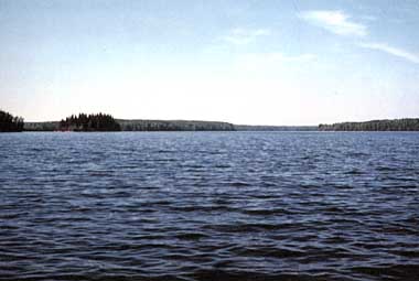
Photo: D.Webb and E.E.Prepas
A. LOCATION
- Alberta, Canada.
- 54:5N, 112:7W; 611.6 m above sea level.
B. DESCRIPTION
Amisk Lake is located within Athabasca County in central Alberta. It is 175 km northeast of the city of Edmonton and 15 km east of the village of Boyle. The lake is long and narrow with its main axis running north and south. It has two distinct basins: the larger south basin is very deep (60 m) and the north basin is moderately deep (33 m). The lake derived its name from the local abundance of beaver, "Amisk", in Cree.Amisk Lake lies at the western edge of the Beaver River drainage basin. Skelton Lake drains into Amisk Lake from the west; Long Lake drains into Amisk Lake from the south. Water from Amisk Lake flows over a small control structure at the north end into the Amisk River.
In the early 1940's a mink farm and resort with boat and cabin rentals were established on the northwest shore of the lake. The mink were fed with fish from the lake. Over the years these developments were replaced by two subdivisions and a trailer park which was built at the north end of the lake.
The majority of the shoreline, however, remains undeveloped. Fishing, boating and swimming are popular on Amisk Lake. A public boat launch and a day-use area on the northwest side are operated by the Recreation Board of the County of Athabasca. The sport fishery includes yellow perch, northern pike and walleye. The water quality in Amisk Lake reflects the rich soils in the drainage basin. The lake is surrounded by aspen, willow and clumps of white spruce and lodgepole pine. Waterfowl and shorebirds are abundant, especially in the shallow marshy bays.
Amisk Lake is typical of many deep parkland/boreal lakes of Alberta: it experiences high summer algal biomass and phosphorus levels and very low hypolimnetic oxygen levels in mid to late summer and during the last half of ice-cover. In May 1988 researchers from the University of Alberta, the National Water Research Institute (Environment Canada) and Linde (Union Carbide Canada) designed and installed a system to inject pure oxygen into the deep waters of the north basin. The main objective of this unique long-term project is to increase dissolved oxygen levels in the hypolimnion of the north basin. It is anticipated that this will lead to improved water quality as a consequence of decreased phosphorus release from the lake's bottom sediments. The proportion of the basin providing year-round habitat and food resources for sport fish should also be increased (1-8).
C. PHYSICAL DIMENSIONS (7, 8, 9)
| Surface area [km2] | 5 |
| Volume [km3] | 0.0998 |
| Maximum depth [m] | 60 |
| Mean depth [m] | 15.5 |
| Water level | Regulated |
| Normal range of annual water level fluctuation [m] | 0.1 |
| Length of shoreline [km] | 24.6 |
| Residence time [yr] | 8 |
| Catchment area [km2] | 244 |
D. PHYSIOGRAPHIC FEATURES
D1 GEOGRAPHICAL (8)
- Bathymetric map: Fig. NAM-44-0l.
- Names of main islands: None.
- Number of outflowing rivers and channels (name): 1 (Amisk R.).
D2 CLIMATIC
- Climatic data at Meanook*, 1951-1980 (12)
| Jan | Feb | Mar | Apr | May | Jun | Jul | Aug | Sep | Oct | Nov | Dec | Ann. | |
|---|---|---|---|---|---|---|---|---|---|---|---|---|---|
| Mean temp. [deg C] | -16.0 | -11.0 | -6.0 | -3.1 | 10.4 | 14.1 | 16.6 | 15.2 | 9.8 | 4.9 | -5.4 | -11.8 | 1.5 |
| Precipitation [mm] | 27 | 23 | 21 | 22 | 41 | 92 | 83 | 78 | 45 | 22 | 24 | 24 | 503 |
- Number of hours of bright sunshine: 2,263.7 hr yr-1 (13).
- Solar radiation (Edmonton Stony Plain)[MJ m-2 day-1](14)
| Jan | Feb | Mar | Apr | May | Jun | Jul | Aug | Sep | Oct | Nov | Dec | Ann. |
|---|---|---|---|---|---|---|---|---|---|---|---|---|
| 3.65 | 7.09 | 12.43 | 17.53 | 20.21 | 21.87 | 21.89 | 18.09 | 12.11 | 7.69 | 3.95 | 2.59 | 12.4 |
Bathymetric map [m](8).

- Water temperature [deg C](8, 15)
| Depth [m] | Jan | Feb | Mar | Apr | May | Jun | Jul | Aug | Sep | Oct | Nov | Dec |
|---|---|---|---|---|---|---|---|---|---|---|---|---|
| S*1 | - | - | - | -*2 | 8.1 | 18.0 | 20.6 | 17.6 | 13.3 | - | 3.8 | ice |
| 1 | 0.8 | 0.9 | 1.0 | - | 7.8 | 16.9 | 20.5 | 17.5 | 13.3 | - | 3.9 | 0.4 |
| 2 | 1.6 | 2.4 | 2.0 | - | 7.6 | 15.9 | 20.4 | 17.5 | 13.3 | - | 4.0 | 1.4 |
| 3 | 2.2 | 2.5 | 2.4 | - | 6.8 | 15.3 | 20.3 | 17.4 | 13.3 | - | 4.0 | 2.2 |
| 4 | 2.6 | 2.6 | 2.7 | - | 6.6 | 14.2 | 18.8 | 16.4 | 13.3 | - | 4.0 | 2.4 |
| 5 | 2.7 | 2.9 | 2.8 | - | 6.3 | 12.4 | 18.0 | 16.4 | 13.2 | - | 4.0 | 2.6 |
| 6 | 2.8 | 3.0 | 2.8 | - | 6.1 | 11.0 | 16.4 | 16.4 | 13.2 | - | 4.0 | 2.6 |
| 7 | 2.9 | 3.1 | 3.0 | - | 5.9 | 10.3 | 12.4 | 13.6 | 13.2 | - | 4.0 | 2.8 |
| 8 | 3.0 | 3.1 | 3.0 | - | 5.8 | 9.7 | 10.7 | 12.2 | 12.6 | - | 4.0 | 2.9 |
| 9 | 3.0 | 3.1 | 3.1 | - | 5.6 | 8.8 | 8.6 | 9.0 | 12.3 | - | 4.0 | 3.0 |
| 10 | 3.0 | 3.1 | 3.2 | - | 4.9 | 8.0 | 7.2 | 8.0 | 11.2 | - | 4.0 | 3.0 |
| 11 | 3.1 | 3.2 | 3.2 | - | 4.8 | 7.2 | 7.0 | 7.4 | 9.3 | - | 4.0 | 3.1 |
| 12 | 3.1 | 3.2 | 3.2 | - | 4.7 | 6.8 | 6.8 | 7.2 | 7.8 | - | 4.0 | 3.1 |
| 13 | 3.1 | 3.2 | 3.2 | - | 4.7 | 6.4 | 6.6 | 6.9 | 7.5 | - | 4.0 | 3.2 |
| 14 | 3.1 | 3.2 | 3.2 | - | 4.7 | 6.1 | 6.2 | 6.6 | 7.2 | - | 4.0 | 3.2 |
| 15 | 3.1 | 3.3 | 3.2 | - | 4.5 | 5.8 | 6.2 | 6.4 | 7.0 | - | 4.0 | 3.2 |
| 16 | 3.2 | 3.3 | 3.4 | - | 5.4 | 5.8 | 6.0 | 6.4 | 6.8 | - | 4.0 | 3.2 |
| 17 | 3.2 | 3.3 | 3.4 | - | 4.3 | 5.6 | 5.9 | 6.2 | 6.6 | - | 4.0 | 3.2 |
| 18 | 3.2 | 3.3 | 3.4 | - | 4.3 | 5.5 | 5.8 | 6.2 | 6.6 | - | 4.0 | 3.4 |
| 19 | 3.3 | 3.3 | 3.4 | - | 4.2 | 5.5 | 5.8 | 6.1 | 6.5 | - | 4.1 | 3.4 |
| 20 | 3.3 | 3.4 | 3.4 | - | 4.2 | 5.4 | 5.8 | 6.0 | 6.5 | - | 4.1 | 3.4 |
| 21 | 3.4 | 3.4 | 3.4 | - | 4.1 | 5.4 | 5.8 | 6.0 | 6.4 | - | 4.1 | 3.4 |
| 22 | 3.5 | 3.4 | 3.4 | - | 4.1 | 5.4 | 5.8 | 6.0 | 6.4 | - | 4.1 | 3.4 |
| 23 | 3.5 | 3.5 | 3.4 | - | 4.1 | 5.4 | 5.6 | 6.0 | 6.4 | - | 4.2 | 3.6 |
| 24 | 3.5 | 3.5 | 3.4 | - | 4.1 | 5.3 | 5.6 | 6.0 | 6.3 | - | 4.2 | 3.6 |
| 25 | 3.5 | 3.5 | 3.5 | - | 4.1 | 5.3 | 5.6 | 5.8 | 6.3 | - | 4.2 | 3.6 |
| 26 | 3.5 | 3.4 | 3.6 | - | 4.0 | 5.2 | 5.6 | 5.8 | 6.3 | - | 4.1 | 3.6 |
| 27 | 3.6 | 4.6 | 3.6 | - | 4.0 | 5.2 | 5.6 | 5.8 | 6.3 | - | 4.1 | 3.6 |
| 28 | 3.6 | 3.6 | 3.6 | - | 4.0 | 5.2 | 5.6 | 5.8 | 6.3 | - | 4.1 | 3.6 |
| 29 | 3.6 | 3.6 | 3.8 | - | 4.0 | 5.2 | 5.6 | 5.8 | 6.3 | - | 4.1 | 3.6 |
| 30 | 3.6 | 3.8 | 3.8 | - | 4.0 | 5.2 | 5.6 | 5.8 | 6.3 | - | 4.1 | 3.6 |
Fig. NAM-44-02
Temperature-depth profile for South basin (1).

- Freezing period: Middle to late November-middle to late April.
- Mixing type: Partially meromictic.
- Notes on water mixing and thermocline formation
Spring and fall mixing has been incomplete in both basins in the past. Thermocline forms any time from early May to early June between depths of 5 to 10 m.
E. LAKE WATER QUALITY
E1 TRANSPARENCY [m](8)
| Jan | Feb | Mar | Apr | May | Jun | Jul | Aug | Sep | Oct | Nov | Dec |
|---|---|---|---|---|---|---|---|---|---|---|---|
| 4.8 | 6.9 | 6.0 | - | 3.1 | 3.3 | 2.5 | 2.2 | 2.7 | 3.9 | - | 7.5 |
E2 pH (8)
| Depth [m] | Jan | Feb | Mar | Apr | May | Jun | Jul | Aug | Sep | Oct |
|---|---|---|---|---|---|---|---|---|---|---|
| 0 | 7.9 | 7.8 | 7.7 | - | 8.3 | 8.6 | 8.8 | 9.0 | 8.4 | 8.0 |
| 3 | 8.0 | 7.8 | 7.7 | - | 8.3 | 8.6 | 8.8 | 8.8 | 8.4 | 7.7 |
| 8 | 8.0 | 7.8 | 7.8 | - | 7.8 | 7.9 | 7.8 | 7.8 | 8.4 | 7.7 |
| 18 | 7.9 | 7.8 | 7.8 | - | 7.7 | 7.6 | 7.5 | 7.6 | 7.7 | 7.6 |
| 30 | 7.8 | - | 7.8 | - | 7.6 | 7.5 | 7.5 | 7.5 | 7.6 | 7.7 |
E4 DO [mg l-1](8, 16)
| Depth [m] | Jan | Feb | Mar | Apr | May | Jun | Jul | Aug | Sep | Oct | Nov | Dec |
|---|---|---|---|---|---|---|---|---|---|---|---|---|
| 1 | 6.45 | 6.04 | 5.62 | *- | - | - | - | - | - | - | 8.12 | 8.34 |
| 2 | 6.22 | 5.80 | 5.24 | - | - | - | - | - | - | - | 8.09 | 7.96 |
| 3 | 6.01 | 5.46 | 4.78 | - | - | - | - | - | - | - | 8.06 | 7.70 |
| 4 | 5.79 | 5.35 | 4.41 | - | - | - | - | - | - | - | 7.80 | 7.64 |
| 5 | 5.50 | 5.25 | 4.10 | - | - | - | - | - | - | - | 7.53 | 7.81 |
| 6 | 5.37 | 4.71 | 3.62 | - | - | - | - | - | - | - | 7.74 | 7.97 |
| 7 | 5.15 | 4.47 | 3.18 | - | - | 9.34 | 3.30 | 3.98 | 9.32 | - | 7.94 | 8.14 |
| 8 | 4.73 | 4.23 | 3.23 | - | - | - | - | - | - | - | 7.95 | 7.93 |
| 9 | 4.31 | 3.52 | 2.60 | - | - | - | - | - | 6.76 | - | 7.95 | 7.72 |
| 10 | 3.89 | 3.08 | 2.12 | - | - | - | - | - | 3.38 | - | 8.01 | 7.57 |
| 11 | 3.75 | 2.64 | 1.72 | - | - | - | - | - | 1.12 | - | 8.06 | 7.36 |
| 12 | 3.60 | 2.45 | 1.51 | - | - | 4.04 | 1.12 | 0.06 | 0.05 | - | 8.06 | 7.14 |
| 13 | 3.37 | 2.25 | 1.14 | - | - | - | - | - | 0.06 | - | 8.06 | 6.94 |
| 14 | 3.14 | 2.05 | 0.74 | - | - | - | - | - | 0.04 | - | 8.05 | 6.74 |
| 15 | 2.90 | 1.82 | 0.36 | - | - | - | - | - | - | - | 8.04 | 6.43 |
| 16 | 2.65 | 1.44 | 0.21 | - | - | - | - | - | - | - | 8.06 | 6.13 |
| 17 | 2.21 | 1.05 | 0.11 | - | - | 2.53 | 0.08 | 0.21 | - | - | 8.08 | 5.83 |
| 18 | 1.77 | 0.73 | 0.01 | - | - | - | - | - | - | - | 8.03 | 5.40 |
| 19 | 1.27 | 0.40 | 0.01 | - | - | - | - | - | - | - | 7.98 | 4.96 |
| 20 | 0.77 | 0.31 | 0.01 | - | - | - | - | - | - | - | 8.08 | 4.34 |
| 21 | 0.59 | 0.22 | 0.00 | - | - | - | - | - | - | - | 8.19 | 3.72 |
| 22 | 0.40 | 0.18 | 0.00 | - | - | 2.19 | 0.06 | 0.00 | - | - | 8.20 | 3.11 |
| 23 | 0.27 | 0.13 | 0.00 | - | - | - | - | - | - | - | 8.20 | 2.79 |
| 24 | 0.13 | 0.07 | 0.00 | - | - | - | - | - | - | - | 8.19 | 2.46 |
| 25 | 0.00 | 0.00 | 0.00 | - | - | - | - | - | - | - | 8.17 | 2.04 |
| 26 | 0.00 | 0.00 | 0.00 | - | - | - | - | - | - | - | 8.17 | 1.87 |
| 27 | 0.00 | 0.00 | 0.00 | - | - | 1.90 | 0.16 | 0.00 | - | - | 8.17 | 1.74 |
| 28 | 0.00 | 0.00 | 0.00 | - | - | - | - | - | - | - | 8.12 | 1.60 |
| 29 | 0.00 | 0.00 | 0.00 | - | - | - | - | - | - | - | 8.06 | 1.60 |
| 30 | 0.00 | 0.00 | 0.00 | - | - | 1.96 | - | 0.00 | - | - | 8.06 | 0.98 |
Fig. NAM-44-03
DO-depth profile for South basin (1).

E6 CHLOROPHYLL CONCENTRATION [micro l-1](8)
| Depth [m] | Jan | Feb | Mar | Apr | May | Jun | Jul | Aug | Sep | Oct | Nov | Dec |
|---|---|---|---|---|---|---|---|---|---|---|---|---|
| 0-6* | 1.2 | 0.8 | 0.8 | - | 5.3 | 7.7 | 10.9 | 11.9 | 9.1 | - | - | - |
| 3 | - | - | - | - | 4.1 | 9.0 | 16.4 | 18.5 | - | - | - | - |
| 8 | - | - | - | - | 7.3 | 4.4 | 3.9 | 4.6 | - | - | - | - |
| 18 | - | - | - | - | 2.3 | 0.8 | 1.0 | 0.8 | - | - | - | - |
E7 NITROGEN CONCENTRATION (8)
- NO2 + NO3 + NH4-N [micro l-1]
| Depth [m] | Jan | Feb | Mar | Apr | May | Jun | Jul | Aug | Sep | Oct | Nov | Dec |
|---|---|---|---|---|---|---|---|---|---|---|---|---|
| 3 | - | - | - | - | 1.4 | 12.2 | 10.9 | 6.0 | 21.1 | 9.7 | - | - |
| 8 | - | - | - | - | 7.7 | 74.8 | 59.9 | 9.4 | 13.5 | 19.0 | - | - |
| 18 | - | - | - | - | 197 | 248 | 279 | 275 | 309 | 229 | - | - |
| 30 | - | - | - | - | 227 | 287 | 287 | 301 | 340 | 318 | - | - |
E8 PHOSPHORUS CONCENTRATION (8)
- Total-P [mg l-1]
| Depth [m] | Jan | Feb | Mar | Apr | May | Jun | Jul | Aug | Sep | Oct | Nov | Dec |
|---|---|---|---|---|---|---|---|---|---|---|---|---|
| 0-6* | 59.1 | 57.6 | 61.3 | - | 34.3 | 27.6 | 31.0 | 28.2 | 31.2 | 43.4 | - | - |
| 0-6 | 50.4 | 54.5 | 55.6 | - | 34.5 | 28.4 | 30.2 | 29.1 | 29.9 | 51.8 | - | 48.6 |
| 6-12 | 51.0 | 54.8 | 55.7 | - | 49.5 | 61.3 | 68.0 | 62.8 | 49.9 | 48.0 | - | 46.8 |
| 12-18 | 51.8 | 54.8 | 57.2 | - | 69.5 | 85.4 | 100 | 107 | 114 | 44.5 | - | 47.3 |
| 18-24 | 53.8 | 56.9 | 57.1 | - | 77.5 | 88.8 | 107 | 118 | 123 | 42.5 | - | 47.3 |
| 24-30 | 61.8 | 58.2 | 57.5 | - | 66.8 | 93.0 | 113 | 122 | 147 | 42.5 | - | 65.4 |
| 30-33 | - | - | - | - | 81.6 | 96.0 | 114 | 124 | 144 | 45.9 | - | - |
Fig. NAM-44-04
Seasonal changes in Total-P, chlorophyll a and transparency (Secchi
depth)(1).

E9 CHLORIDE CONCENTRATION
- 2. [mg l-1]
F. BIOLOGICAL FEATURES
F1 FLORA
- Emerged macrophytes: Scirpus validus.
- Floating macrophytes: Nuphar variegatum.
- Submerged macrophytes
- Phytoplankton (8)
Potamogeton richardsonii, P. vaginatus, Myriophyllum exalbescens, Chara spp.
Spring: Bacillariophyta and Cryptophyta.
Summer Cyanophyta (Aphanizomenon flos-aquae, Gomphosphaeria sp., Anabaena dircinalis) and Pyrrophyta (dinoflagellates).
F2 FAUNA
- Zooplankton (8, 16, 17)
- Benthos: Western limit of Oreonectes virilus (crayfish).
- Fish (18)
Spring: Acanthocyclops vernalis, Mesocyclops edax.
June: Bosmina longirostris.
July: Daphnia galeata mendotae.
August: Diaphanosoma leuchtenbergianum.
Perca flavescens, Esox lucius, Stizostedion vitreum vitreum*, Coregonus clupeaformis, C. artedii*, Catostomus commersoni, Lota lota, Notropis hudsonius, Culaea inconstans, Pungitius pungitius, Etheostoma exile.
* Economically important.
F4 BIOMASS
- Plankton [mg (dry wt.) m-3]
| Depth [m] | Size fraction | May | Jun | Jul | Aug |
|---|---|---|---|---|---|
| 0-6 | <64 micro m | 247 | 440 | 532 | 483 |
| 0-6 | <243 micro m | 165 | 317 | 251 | 161 |
F5 FISHERY PRODUCTS (19)
- Annual fish catch [kg yr-1]
1985: 4870*1.
1981-1986: 4,913*2.
*1 Sport-fisheries.
*2 Commercial fisheries.
F6 PAST TRENDS (20)
- Average commercial harvest has dropped from 9,848 kg yr-1 (1944-1961)
to 4,913 kg yr-1 (1981-1986).
G. SOCIO-ECONOMIC CONDITIONS
G1 LAND USE IN THE CATCHMENT AREA (1)
| Area [km2] | [%] | |
|---|---|---|
| Natural landscape | 214.7 | 88 |
| Agricultural land | 9.8 | 4 |
| Others | 19.5 | 8 |
| Total | 244.0 | 100 |
- Types of important forest vegetation
Populus tremuloides, P. balsamifera, Pinus contorta (20).
G2 INDUSTRIES IN THE CATCHMENT AREA AND THE LAKE (1)
| Main products or major industries | |
|---|---|
| Primary industry | |
| - Crop production | Hay, cereal crops |
| Tertiary industry | Small public boat launch on northwest side of the lake |
G3 POPULATION IN THE CATCHMENT AREA (8)
| Population | Population density [km-2] | Major cities (population) | |
|---|---|---|---|
| Urban | 0 | 0 | |
| Rural | <100* | <1 | None |
| Total | <100 | <1 |
H. LAKE UTILIZATION
H1 LAKE UTILIZATION
- Recreation (swimming, sport-fishing, boating) and fisheries.
H2 THE LAKE AS WATER RESOURCE
- 1988: Use rates of a small amount of domestic water unknown.
I. DETERIORATION OF LAKE ENVIRONMENTS AND HAZARDS
I1 ENHANCED SILTATION
- Extent of damage: None.
I3 EUTROPHICATION
- Nuisance caused by eutrophication (8)
- Supplementary notes (6, 17)
Unusual algal bloom (Cyanophyta Aphanizomenon flos-aquae, Anabaena circinalis, Gomphospheria).
Limited settlement along the lake shore may have enhanced phosphorus loading.
However, most of the phosphorus load comes from the rich soils in the drainage basin and from internal loading.
J. WASTEWATER TREATMENTS
J1 GENERATION OF POLLUTANTS IN THE CATCHMENT AREA
- (b) No major pollution of the lake.
K. IMPROVEMENT WORKS IN THE LAKE
K2 AERATION
- A project started in May 1988, involving the injection of pure oxygen
into the deep waters of the north basin. The intent is to keep dissolved
oxygen concentrations above 2 mg l-1 throughout the entire water column
year round. Injection rates over the first year have varied from 0.25 to
1 ton liquid oxygen per day. The system involves a pressurized storage
tank on the shore, approximately 1.4 km of thick walled hose from the shore
to the deepest site in the basin and a 15 x 2.4 m diffuser constructed
with Porex tubing. The diffuser sits at a depth of 34 m. This process was
chosen to improve fisheries habitat. The impact on water quality is also
being evaluated. This process was chosen because it is relatively economical
and ideal for remote sites.
M. LEGISLATIVE AND INSTITUTIONAL MEASURES FOR UPGRADING LAKE ENVIRONMENTS
Ml NATIONAL AND LOCAL LAWS CONCERNED- Names of the laws
- Clean Water Act
- Clean Air Act
- Public Health Act
- Responsible authorities
- Alberta Ministry of the Environment
- Alberta Ministry of the Environment
- Main items of control
- Industrial and municipal discharges
M2 INSTITUTIONAL MEASURES (the year of establishment)
- Alberta Ministry of the Environment, Edmonton - Monitoring of lakes and pollution control (1970)
M3 RESEARCH INSTITUTES ENGAGED IN THE LAKE ENVIRONMENT STUDIES
- University of Alberta has been monitoring water quality since 1980; oxygenation project started 1988.
- National Water Research Institute, Environment Canada, involved with oxygenation project started 1988.
N. SOURCES OF DATA
- Questionnaire filled by Drs. D. Webb & E. Prepas, Department of Zoology, The University of Alberta Edmonton, Alberta.
- Prepas, E. E. (1990) Amisk Lake. "Atlas of Alberta Lakes" (ed. Mitchell, P. A. & Prepas, E. E.), in press, the University of Alberta Press, Edmonton.
- Chipeniuk, R. C. (1975) Lakes of the Lac la Biche District. R. C.
- Holmgren, E. J. & P. M. (1976) Over 2000 Place Names of Alberta. 3rd ed.
- Boyle and District Historical Society (1982) Forests, Furrows and faith: A History of Boyle District. Boyle, Alberta: Boyle and District Historical Society, Athabasca.
- Prepas, E. E. & Trimbee, A. M. (1987) Evaluation of indicators of nitrogen limitation in deep prairie lakes with laboratory bioassays and limnocorrals. Hydrobiol. 159; 269-276.
- Prepas, E. E. & Vickery, J. (1984) Seasonal changes in total phosphorus and the role of internal loading in western Canadian lakes. Verh. Int.
- Babin, J. & Prepas, E. E. (1985) Modelling winter oxygen depletion rates in ice-covered temperate zone lakes in Canada. Can. J. Fish. Aquat. Sci., 42: 239-249.
- Prepas, E. E., Webb, D. J., Wisheu, I. & Trimbee, A. M. Unpublished data.
- Alberta Environment, Technical Services Division, Hydrology Branch. Unpublished data. Edmonton.
- Prepas, E. E. & Trew, D. O. (1983) Evaluation of the phosphorus- chlorophyll relationship for lakes off the Precambrian Shield in western Canada. Can. J. Fish. Aquat. Sci., 40: 27-35.
- Province of Alberta, Canada 1987 Official Road Map. Government of Alberta.
- Environment Canada, Atmospheric Environment Service. Canadian Climate Normals, Temperature and Precipitation (1951-1980), Prairie Provinces. Supply Serv., Ottawa.
- Environment Canada, Atmospheric Environment Service (1982) Canadian Climate Normals, Vol. 7, Bright Sunshine (1951-1980). Supply Serv., Ottawa.
- Environment Canada, Atmospheric Environment Service. Canadian Climate Normals, 1951-1980, Solar Radiation. Supply Serv., Ottawa.
- Prepas, E. E. (1983) The Influence of Phosphorus and Zooplankton on Chlorophyll Levels in Alberta Lakes. Alberta Environment, Res. Manage.
- Babin, J. (1984) Winter oxygen depletion in temperate zone lakes. M.
- Prepas, E. E. & J. Vickery (1984) The contribution of particulate phosphorus (>250 micro m) to the total phosphorus pool in lake water. Can. J.
- Norris, H. J. (1987) Alberta Fish and Wildlife Division, St. Paul. Personal communication as cited in (1).
- Sullivan, M. G. (1987) Characteristics and Impact of the Sport Fishery at Amisk Lake during May-August 1985. Alberta Energy and Natural Resources, Fish and Wildlife Division, St. Paul.
- Strong, W. L. & K. R. Leggat (1981) Ecoregions of Alberta. Alberta Energy Nat. Res., Resource Eval. Plan. Div., Edmonton.
Chipeniuk, Lac la Biche, Alberta.
Saskatoon, Saskatchewan: Western Producer Prairie Books, Saskatoon.
Verein. Limnol., 223: 303-308.
University of Alberta, Edmonton.
Div., Rep. 83/23. Edmonton.
Sc. Thesis, University of Alberta, Edmonton. 108 pp.
Fish. Aquat. Sci., 41: 351-363.
