
BAPTISTE LAKE
An aerial view of the whole lake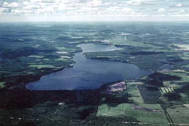
Photo: E.E.Prepas, D.Webb and D.D.Trew
A. LOCATION
- Alberta, Canada.
- 54:5N, 113:3W; 578 m above sea level.
B. DESCRIPTION
Baptiste Lake is a very productive medium-sized lake located within the County of Athabasca in central Alberta. It has two distinct basins joined by a long neck, called the Narrows. Both basins are similar in size; the north basin is shallow (15.5 m), whereas the south basin is deep (27.5 m). The lake is situated 165 km northwest of the City of Edmonton and 16 km west of the Town of Athabasca.The lake was named after Baptiste Majeau, an early settler in the area. The first permanent native settlement on Baptiste Lake was established in the 1880's by a group of Metis from Saskatchewan. They lived on long, narrow lake-front lots. By 1904 farming had begun in the drainage basin, and by 1909 most of the land that was not already settled was available for homesteaders. Much of the present agricultural land was broken first in the period up to 1915.
Although most of the drainage basin, particularly in the western section, remains undeveloped, much of the land around the lake is cleared. There are three private campgrounds and five summer villages on the lake.
The lake is used heavily for fishing, boating and swimming. The public boat launch on the southwest corner is part of a day-use area that includes a large dock, washrooms, picnic shelter and picnic tables. It is operated by the County of Athabasca. There are also private boat launches at the resorts on the south side of the lake, and a small confectionary store. Popular sport fishes include yellow perch, northern pike and walleye. The water quality in Baptiste Lake reflects the nutrient-rich soils in the drainage basin; very dense algal blooms can develop in summer. The shallower north basin generally has heavier blooms than the deeper south basin, but both are classified as hypertrophic.
In the early 1970's, concerns were raised about
the effects of rapid development on the many users of the lake and on aspects
of water quality. These concerns were followed up in 1975 with an evaluation
of cottagers. From 1976 through 1979, Alberta Environment carried out an
intensive water quality study of the lake. The goals of this project were
to develop methods to evaluate the impact of past, present and future developments,
and to manage the water quality of Alberta lakes. In 1977, most lake development
was halted while a management plan was developed. In 1979, Alberta Municipal
Affairs, in conjunction with the County of Athabasca, developed a plan
that would prohibit further subdivision of land for non-farm related residential
use at Baptiste Lake. This plan also recommended an approach to deal with
concerns about fluctuating water levels and hazardous boating speeds near
the lakeshore. As of August 1988, no regulations had been implemented to
deal with the concerns on water levels and boating speeds (2-8).
C. PHYSICAL DIMENSIONS (9, 10, 11)
| Surface area [km2] | 10 |
| Volume [km3] | 0.0846 |
| Maximum depth [m] | |
| - (North) | 15.5 |
| - (South) | 27.5 |
| Mean depth [m] | |
| - (North) | 5.9 |
| - (South) | 12.7 |
| Water level | Unregulated |
| Normal range of annual water level fluctuation [m] | 0.2-1 |
| Length of shoreline [km] | 26.4 |
| Residence time [yr] | 6 |
| Catchment area [km2] | 288 |
D. PHYSIOGRAPHIC FEATURES
D1 GEOGRAPHICAL
- Sketch map: Fig. NAM-43-01.
- Bathymetric map: Fig. NAM-43-02.
- Names of main islands: None.
- Number of outflowing rivers and channels (name): 1 (Baptiste Creek).
D2 CLIMATIC
- Climatic data
| Jan | Feb | Mar | Apr | May | Jun | Jul | Aug | Sep | Oct | Nov | Dec | Ann. | |
|---|---|---|---|---|---|---|---|---|---|---|---|---|---|
| Mean temp. [deg C]*1 | -17.9 | -11.9 | -6.4 | 3.4 | 10.1 | 14.1 | 16.2 | 14.8 | 9.5 | 4.6 | -6.1 | -13.8 | 1.4 |
| Precipitation [mm]*2 | 25 | 25 | 17 | 18 | 45 | 66 | 114 | 69 | 46 | 20 | 22 | 33 | 499 |
*2 Baptiste Lake, 1972-1977 (10).
- Number of hours of bright sunshine: 2,160 hr yr-1 (12a).
- Solar radiation (Edmonton Stony Plain*)[MJ m-2 day-1](13, 14).
| Jan | Feb | Mar | Apr | May | Jun | Jul | Aug | Sep | Oct | Nov | Dec | Ann. |
|---|---|---|---|---|---|---|---|---|---|---|---|---|
| 3.65 | 7.09 | 12.43 | 17.53 | 20.21 | 21.87 | 21.89 | 18.09 | 12.11 | 7.69 | 3.95 | 2.59 | 12.4 |
Fig. NAM-43-01
Sketch map of the lake.

- Fig. NAM-43-02
Bathymetric map [m](11).

- Fig. NAM-43-03
Water temperature [deg C] South basin, Junuary-October 1986 (1) and November- March 1982 and 1983 (14).

- Fig. NAM-43-04
Water temperature [deg C] North basin, Junuary-October 1986 and January-February 1987 (1).

- Freezing period: Middle to late November-middle to late April.
- Mixing type: Partially meromictic.
- Notes on water mixing and thermocline formation
Appears to exhibit partial meromixis. Difference in specific conductance between surface and bottom waters varies from <10 to >50 over the course of a year. Mixing in spring and fall incomplete in the south basin in most years.
E. LAKE WATER QUALITY
E1 TRANSPARENCY [m](1)
| Jun | Jul | Aug | Sep | Oct |
|---|---|---|---|---|
| 2.2 | 2.2 | 1.1 | 2.2 | 2.6 |
E2 pH (1)
| Depth [m] | 5 Jun | 3 Jul | 7 Aug | 28 Aug | 25 Sep | 29 Oct |
|---|---|---|---|---|---|---|
| 0 | 8.3 | 8.4 | 8.7 | 8.8 | 8.2 | 7.6 |
| 2 | 8.4 | 8.4 | 8.4 | 8.8 | 8.1 | 7.6 |
| 4 | 8.2 | 8.3 | 8.1 | 8.5 | 8.2 | 7.6 |
| 6 | 7.7 | 7.8 | 7.7 | 8.4 | 8.2 | 7.6 |
| 8 | 7.4 | 7.5 | 7.3 | 8.3 | 8.1 | 7.6 |
| 10 | 7.3 | 7.4 | 7.1 | 7.4 | 8.1 | 7.6 |
| 12 | 7.1 | 7.4 | 7.0 | 7.3 | 8.1 | 7.6 |
| 14 | 7.0 | 7.4 | 6.9 | 7.2 | 7.3 | 7.6 |
| 16 | 6.9 | 7.4 | 6.9 | 7.1 | 7.2 | 7.6 |
| 18 | 6.9 | 7.4 | 6.8 | 7.1 | 7.2 | 7.4 |
| 20 | 6.8 | 7.4 | 6.7 | 7.0 | - | 7.3 |
| 22 | 6.8 | 7.3 | 6.6 | 7.0 | - | 7.2 |
| 24 | - | 7.3 | - | - | - | 7.0 |
E3 SS [mg m-2](10)
- April-November 1976: 5,986*.
April-November 1977: 5,028*.
* Mean ash-free dry wt.
E4 DO [mg l-1]: Fig. NAM-43-05 and 06.
- Fig. NAM-43-05
South basin, June-October 1986 (1) and November-March 1982-1983 (15).

- Fig. NAM-43-06
North basin, June-October 1986 and January-February 1987 (1).

E6 CHLOROPHYLL CONCENTRATION [micro l-1](1)
| Depth [m] | 5 Jun | 3 Jul | 7 Aug | 28 Aug | 25 Sep | 29 Oct |
|---|---|---|---|---|---|---|
| E* | 11.1 | 10.9 | 33.6 | 41.2 | 19.3 | 5.7 |
E7 NITROGEN CONCENTRATION (1)
- Total-N concentration [mg l-1]
| Depth [m] | 5 Jun | 3 Jul | 7 Aug | 28 Aug | 25 Sep | 29 Oct |
|---|---|---|---|---|---|---|
| E* | 0.863 | 1.019 | 1.173 | 1.18 | 0.954 | 1.060 |
E8 PHOSPHORUS CONCENTRATION (1)
- Total-P [mg l-1]
| Depth [m] | 5 Jun | 3 Jul | 7 Aug | 28 Aug | 25 Sep | 29 Oct |
|---|---|---|---|---|---|---|
| E* | 0.039 | 0.033 | 0.042 | 0.051 | 0.047 | 0.084 |
Fig. NAM-43-07
Total-P, Chlorophyll a and Secchi depth in North basin in 1986 (2).

- Fig. NAM-43-08
Total-P, chlorophyll a and Secchi depth in South basin in 1986 (2).

E9 CHLORIDE CONCENTRATION
- 2. [mg l-1]
F. BIOLOGICAL FEATURES
F1 FLORA
- Emerged macrophytes (16)
- Floating macrophytes: Lemnor minor, L. trisulca, Spirodela polyrhiza (16).
- Floating leaf macrophytes: Nuphar variegatum (16).
- Submerged macrophytes (16)
- Phytoplankton (1)
Typha latifolia, Scirpus validus, Nuphar variegatum, Phragmites communis. Additional species identified; Carex sp., Equisetum fluviatile, Polygonum natans, Sparganium eurycarpum.
Potamogeton richardsonii, P. friesii, P. pectinatus, P. pusillus, P.
vaginatus, P. zosteriformis, Myriophyllum exalbescens, Ranunculus circinatus, Ruppia maritima, Sagittaria cuneata.
Dominant phytoplankton in the South basin in order of biomass (epilimnion composites), 1986.
| Date | Species |
|---|---|
| 5 Jun | Synedra delicatissima, Peridinium willie, Uroglena americana, Cyclotella kutzingiana, Cryptomonas erosa |
| 3 Jul | Anabaena flos-aquae, Oscillatoria agardhii, Aphanizomenon flosaquae, Ceratium hirundinella |
| 7 Aug | Ceratium hirundinella, Anabaena flos-aquae, Aphanizomenon flosaquae, Peridinium willie, Microcystis aeruginosa |
| 28 Aug | Ceratium hirundinella, Melosira granulata, Anabaena flos-aquae, Stephanodiscus niagarae, Peridinium willie |
| 25 Sep | Melosira italica, M. granulata, Ceratium hirundinella, Stephanodiscus niagarae, Cryptomonas erosa |
| 29 Oct | Cryptomonas erosa, C. reflexa, Melosira italica, Mallomonas tonsurata |
| (1). | ||||||
| 5 Jun | 3 Jul | 7 Aug | 28 Aug | 25 Sep | 29 Oct | |
|---|---|---|---|---|---|---|
| Chlorophyta | 3.0 | 1.0 | 1.3 | 0.5 | 1.0 | 6.5 |
| Cyanophyta | 0.0 | 86.7 | 38.4 | 7.4 | 15.9 | 14.8 |
| Chrysophyta | 15.5 | 0.6 | 0.2 | 0.0 | 0.9 | 11.0 |
| Bacillariophyta | 44.6 | 4.2 | 1.0 | 9.9 | 58.4 | 20.2 |
| Pyrrhophyta | 25.4 | 5.1 | 57.9 | 80.3 | 10.7 | 1.1 |
| Cryptophyta | 11.5 | 2.3 | 1.1 | 1.8 | 13.2 | 46.3 |
F2 FAUNA (10)
- Zooplankton
- Fish
South basin
Rotifers (Keratella quadrata, K. cochlearis, K. testudo, Kellicottia longispina, Asplanchna priodonta, Filinia longiseta, Conochilus unicornis, C.
natans, Synchaeta, Polyarthra dolichoptera, Pompholyx sulcata, Trichocerca multicrinis, Brachionus angularis); Crustacea (Diacyclops bicuspidatus thomasi, Bosmina longirostris, Daphnia galeata mendotae, D. pulex, D.
pulicaria, D. retrocarva, Ceriodaphnia lacustris, Chydorus sphaericus, Diaptomus oregonensis, Acanthocyclops vernalis, Leptodora kindti, Diaphanosoma leuctenbergianum, Mesocyclops edax); Diptera (Chaoborus flavicans).
Perca flavescens, Esox lucius, Stizostedion vitreum, Coregonus artedii, Lota lota, Catostomus commersoni, Notropis hudsonius, Etheostoma exile, Culaea inconstans, Pungitius pungitius, Thymallus arcticus (in tributary streams).
F3 PRIMARY PRODUCTION RATE (10)
- Annual primary production rate [g C m-2 yr-1]
South basin, October 1976-November 1977: 250.
F4 BIOMASS
- Alga [mg (wet wt.) l-1](1)
| Depth | 6/5 | 7/3 | 8/7 | 8/28 | 9/25 | 10/29 |
|---|---|---|---|---|---|---|
| Euphotic zone
(composite sample) |
2.16 | 2.57 | 8.26 | 11.88 | 2.30 | 0.95 |
- Zooplankton*1 [micro P l-1]*2 (17)
| Depth | 5/18 | 6/8 | 6/28 | 7/20 | 8/10 | 9/1 | 9/21 |
|---|---|---|---|---|---|---|---|
| Euphotic zone
(composite sample) |
0.2 | 0.2 | 1.9 | 7.6 | 9.3 | 7.2 | 3.9 |
G. SOCIO-ECONOMIC CONDITIONS (10)
G1 LAND USE IN THE CATCHMENT AREA
| Area [km2] | [%] | |
|---|---|---|
| Natural landscape | ||
| - Woody vegetation*1 | 1,706.5 | 59.3 |
| - Swamp*2 | 644.2 | 22.4 |
| - Others*3 | <34.7 | 1.2 |
| Agricultural land | 482.3 | 16.8 |
| Residential area | <10 | 0.3 |
| Total | 2,877.7 | 100 |
*2 Wetland.
*3 Lakes & ponds.
- Types of important forest or scrub vegetation
- Main kinds of crops and cropping system: Mixed farming.
Picea mariana, Populus tremuloides, P. balsamifera, Salix sp., Betula sp.
G3 POPULATION IN THE CATCHMENT AREA (10)
| Population | Population density [km-2] | Major cities (population) | |
|---|---|---|---|
| Urban | 0 | 0 | |
| Rural | 100 | <1 | None |
| Total | 100 | <1 |
H. LAKE UTILIZATION
H1 LAKE UTILIZATION
- Recreation (swimming, sport-fishing and boating).
I. DETERIORATION OF LAKE ENVIRONMENTS AND HAZARDS
I2 TOXIC CONTAMINATION
- Present status: No information.
I3 EUTROPHICATION
- Nuisance caused by eutrophication
- Nitrogen and phosphorus loadings to the lake [kg yr-1](10)
Unusual algal bloom (Anabaena spp., Gomphosphaeria sp., Aphanizomenom flos- aquae, Microcystis aeruginosa, Coelosphaerium sp.).
| Sources | Industrial | Others (total) |
|---|---|---|
| T-N | 0 | 37,136 |
| T-P | 0 | 3,407 |
- Supplementary notes (10)
Sediment core analysis confirms that Baptiste Lake has been hypertrophic for centuries.
I4 ACIDIFICATION
- Extent of damage: None.
J. WASTEWATER TREATMENTS
J1 GENERATION OF POLLUTANTS IN THE CATCHMENT AREA
- (c) Some discharge of pollution load into the lake.
J2 APPROXIMATE PERCENTAGE DISTRIBUTION OF POLLUTANT LOADS
| [%] | |
|---|---|
| Non-point sources (agricultural, natural and dispersed settlements) | 100 |
| Total | 100 |
L. DEVELOPMENT PLANS (18)
- Restricted at present.
M. LEGISLATIVE AND INSTITUTIONAL MEASURES FOR UPGRADING LAKE ENVIRONMENTS
M1 NATIONAL AND LOCAL LAWS CONCERNED
- Names of the laws (the year of legislation)
- Clean Water Act
- Clean Air Act
- Public Health Act
- Responsible authorities
- Alberta Ministry of the Environment
- Alberta Ministry of the Environment
- Main items of control
- Industrial and municipal discharges
M2 INSTITUTIONAL MEASURES (the year of establishment)
- Edmonton, Monitoring of Lakes and Pollution Control (1970); Alberta Environment
- Alberta Environment, Environmental Quality Monitoring Branch (1976-1978) and long-term monitoring (1983-present)
M3 RESEARCH INSTITUTES ENGAGED IN THE LAKE ENVIRONMENT STUDIES
- University of Alberta
N. SOURCES OF DATA
- Questionnaire filled by Drs. E. E. Prepas and D. Webb, Department of Zoology, Faculty of Science, University of Alberta, and by Dr. D. D. Trew, Environmental Quality Monitoring Branch, Environmental Assessment Division, Alberta Environment, based on the following sources.
- Alberta Environment, Environmental Quality Monitoring Branch, Environmental Assessment Division, Environmental Protection Services.
- Prepas, E. E. (1990) Baptiste Lake. "Atlas of Alberta Lakes" (ed.
- Holmgren, E. J. & Holmgren, P. M. (1976) Over 2000 Place Names of Alberta. 3rd ed. Western Producer Prairie Books, Saskatoon.
- Athabasca Historical Society, D. Gregory and Athabasca University (1986) Athabasca Landing: An Illustrated History. Athabasca Historical Society, Athabasca.
- Stone, D. (1970) The process of rural settlements in the Athabasca area, Alberta. M. A. Thesis, Department of Geography, University of Alberta, Edmonton.
- Thomas, J. G., Erickson, R. R., Warren, W. W. & Dack, C. T. (1977) Cottage Owner Survey: Island Lake, Baptiste Lake. Alberta Municipal Affairs, Planning Services Division, Edmonton.
- Trew, D. O., Beliveau, D. J. & Yonge, E. I. (1978) The Baptiste Lake Study Summary Report. Alberta Environment, Water Quality Control Branch, Pollution Control Division, Environmental Protection Services, Edmonton.
- Alberta Municipal Affairs, Planning Services Division, Regional Planning Section (1979) Baptiste Lake Area Structure Plan. Prepared for County of Athabasca and Summer Village of Sunset Beach.
- Alberta Environment, Technical Services Division, Survey Branch. Unpublished data, Edmonton.
- Trew, D. O., Beliveau, D. J. & Yonge, E. I. (1987) The Baptiste Lake Study Technical Report. Alberta Environment, Water Quality Control Branch, Pollution Control Division, Environmental Protection Services, Edmonton.
- Alberta Environment, Technical Services Division, Hydrology Branch. Unpublished data, Edmonton.
- Environment Canada, Atmospheric Environment Service (1982) Canadian Climate Normals, Vol. 2: Temperature and precipitation (1951-1980). Supply and Services, Ottawa.
- Environment Canada, Atmospheric Environment Service (1982) Canadian Climate Normals, Vol. 1: Solar radiation (1951-1980). Supply and Services, Ottawa.
- Prepas, E. E. & Babin, J. (University of Alberta). Unpublished data, Edmonton.
- Babin, J. (1984) Winter oxygen depletion in temperate zone lakes. M.
- Stockerl, E. C. & Kent, R. L. (1984) Aquatic Macrophyte Survey of Baptiste and Nakamun Lakes (1984) Prepared for Alberta Environment, Pollution Control Division, by Okanagan Diving Services (OSD) Consultants, Edmonton.
- Prepas, E. E. & Vickery, J. (1984) Contribution of particulate phosphorus (>250 micro m) to the total phosphorus pool in lake water. Can. J.
- Alberta Municipal Affairs (1979) Baptiste Lake Area Structure Plan.
Mitchell, P. A. & Prepas, E. E.), in press, the University of Alberta Press, Edmonton.
(12a) Environment Canada, Atmospheric Environment Service (1982) Canadian Climate Normals, Vol. 7: Bright sunshine (1951-1980). Supply and Services, Ottawa.
Sc. Thesis, Department of Zoology, University of Alberta, Edmonton.
Fish. Aquat. Sci., 41: 351-363.
prep. Prepared for County of Athabasca and summer village of Sunset Beach by Planning and Services Division, Regional Planning Section, Edmonton.
